IMAGES TAKEN NEAR TO
Buttermere Close, PRESTON, PR5 4RT
Introduction
This page details the photographs taken nearby to Buttermere Close, PR5 4RT by members of the Geograph project.
The Geograph project started in 2005 with the aim of publishing, organising and preserving representative images for every square kilometre of Great Britain, Ireland and the Isle of Man.

There are currently over 7.5m images from over14,400 individuals and you can help contribute to the project by visiting https://www.geograph.org.uk
Image Map
Images are licensed for reuse under creativecommons.org/licenses/by-sa/2.0
Notes
- Clicking on the map will re-center to the selected point.
- The higher the marker number, the further away the image location is from the centre of the postcode.
Image Listing (11 Images Found)
Images are licensed for reuse under creativecommons.org/licenses/by-sa/2.0
Image
Details
Distance
2
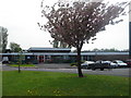
Walton-le-Dale Primary School
Sometimes referred to locally as "Severn Drive School" as its main entrance is on Severn Drive. This photo is taken from the public footpath which runs alongside the school's large playing field (there is quite a bit more out of shot). Much better than the tiny yards some schools have to make do with.
Image: © Adam C Snape
Taken: 27 Dec 2015
0.19 miles
4
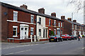
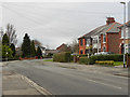
Station Road, Bamber Bridge
This line of terraced houses stands opposite St Aidan's Church in Bamber Bridge. Balshaw Street leads off to the left. Station Road is nowadays the B6258 but was previously a stretch of the A6.
Image: © Stephen McKay
Taken: 19 Apr 2023
0.23 miles
5
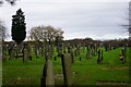
Churchyard of St Mary's, Brownedge
A Catholic churchyard with a distant view of the Forest of Bowland.
Image: © Bill Boaden
Taken: 18 Nov 2017
0.23 miles
6
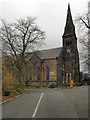
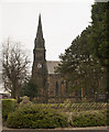
St Mary's RC Church
This large church, capable of holding 1500 worshippers, was built in 1892 to replace an earlier church on the site. It is a Grade II listed building (http://www.britishlistedbuildings.co.uk/en-358033-roman-catholic-church-of-the-blessed-vir - British Listed Buildings)
The church's web site (http://www.stmarysbrownedge.org.uk/history.html ) carries a detailed history of the church and the parish.
Image: © David Dixon
Taken: 25 Feb 2012
0.24 miles
9
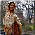
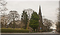
Madonna Carving
The wood carving of Mary, outside Image
Image: © David Dixon
Taken: 25 Feb 2012
0.25 miles