IMAGES TAKEN NEAR TO
Firwood Lane, PRESTON, PR5 0RE
Introduction
This page details the photographs taken nearby to Firwood Lane, PR5 0RE by members of the Geograph project.
The Geograph project started in 2005 with the aim of publishing, organising and preserving representative images for every square kilometre of Great Britain, Ireland and the Isle of Man.

There are currently over 7.5m images from over14,400 individuals and you can help contribute to the project by visiting https://www.geograph.org.uk
Image Map (Loading...)


Getting Data...Please wait
Leaflet Map data © OpenStreetMap
Images are licensed for reuse under creativecommons.org/licenses/by-sa/2.0
Notes
- Clicking on the map will re-center to the selected point.
- The higher the marker number, the further away the image location is from the centre of the postcode.
Image Listing (12 Images Found)
Images are licensed for reuse under creativecommons.org/licenses/by-sa/2.0
Image
Details
Distance
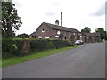
2
White Oak and Turners Farm, Firwood Lane
Image: © Alexander P Kapp
Taken: 21 Mar 2006
0.10 miles
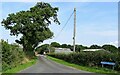
4
A tight turn off Roach Lane into Firwood Lane
Image: © Ian Greig
Taken: 10 May 2013
0.19 miles
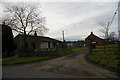
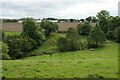
5
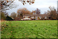
Woodnook farm
The field level is two or three feet higher than Roach road, which runs along the other side of the hedge ahead.
Image: © Mr T
Taken: 17 Nov 2007
0.19 miles
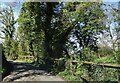
6
Darkwood Lane
At its junction with Firwood Lane.
Image: © philandju
Taken: 2 Sep 2022
0.20 miles
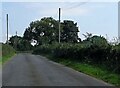
7
Roach Road
Leading from Hoghton to Roach Bridge.
Image: © philandju
Taken: 13 Oct 2022
0.21 miles
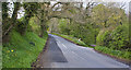
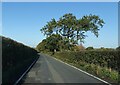
8
Firwood Lane
Approaching its junction with Roach Road.
Image: © philandju
Taken: 4 Apr 2023
0.22 miles
9
Brook below Cardwell's Farm
Looking down from Green Lane.
Image: © Bill Boaden
Taken: 30 Aug 2021
0.22 miles
10
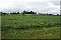
Path towards Stanley Grange
The path crosses a field of cut grass and is accordingly not currently well defined.
Image: © Bill Boaden
Taken: 30 Aug 2021
0.22 miles