
IMAGES TAKEN NEAR TO
Hazelwood Drive, PRESTON, PR4 6PJ
Introduction
This page details the photographs taken nearby to Hazelwood Drive, PR4 6PJ by members of the Geograph project.
The Geograph project started in 2005 with the aim of publishing, organising and preserving representative images for every square kilometre of Great Britain, Ireland and the Isle of Man.

There are currently over 7.5m images from over14,400 individuals and you can help contribute to the project by visiting https://www.geograph.org.uk
Image Map
Images are licensed for reuse under creativecommons.org/licenses/by-sa/2.0
Notes
- Clicking on the map will re-center to the selected point.
- The higher the marker number, the further away the image location is from the centre of the postcode.
Image Listing (14 Images Found)
Images are licensed for reuse under creativecommons.org/licenses/by-sa/2.0
Image
Details
Distance
1
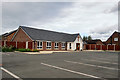
Hesketh Bank Methodist Church, Chapel Road
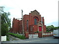
New church on Chapel Road, opened in 2017 replacing the 1938-built Methodist Chapel (Image]).
Image: © David Dixon
Taken: 30 Jun 2019
0.04 miles
2
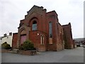
Hesketh Bank Methodist Church
The current Methodist Church which faces Chapel Road is in a dilapidated condition and the church hall to the back of the building also does not meet the future needs of the church.
The proposal includes the demolition of the existing church and church hall and the construction of a new combined church and church hall on Chapel Road, with associated car parking plus 14 new houses.
Image: © Rude Health
Taken: 16 Mar 2015
0.05 miles
5
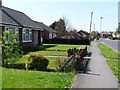
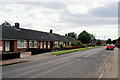
Bungalows on Chapel Road
Looking west from outside the Methodist chapel.
Image: © Christine Johnstone
Taken: 17 Apr 2011
0.09 miles
6
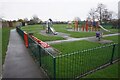
Shore Road Recreation Ground
The land and equipment are owned and maintained by the Parish Council. It is currently raining and there is no-one using it.
Image: © Bill Boaden
Taken: 2 Mar 2024
0.12 miles
7
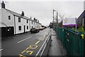
Shore Road
The road is now nowhere near the shore. The farmland to the north nearer to the river has been reclaimed for a long time, so I don't know when this may have been regarded as a shore.
Image: © Bill Boaden
Taken: 2 Mar 2024
0.16 miles
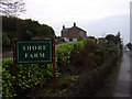
9
Temporary traffic lights on Shore Road
Pending some works by a utility company. It is viewed during rain.
Image: © Bill Boaden
Taken: 2 Mar 2024
0.19 miles
10
Track onto Hesketh Old Marsh
Inclement rainy conditions. The land is used for growing vegetables but much is dormant over the winter months.
Image: © Bill Boaden
Taken: 2 Mar 2024
0.21 miles