IMAGES TAKEN NEAR TO
Liverpool New Road, PRESTON, PR4 5JT
Introduction
This page details the photographs taken nearby to Liverpool New Road, PR4 5JT by members of the Geograph project.
The Geograph project started in 2005 with the aim of publishing, organising and preserving representative images for every square kilometre of Great Britain, Ireland and the Isle of Man.

There are currently over 7.5m images from over14,400 individuals and you can help contribute to the project by visiting https://www.geograph.org.uk
Image Map
Images are licensed for reuse under creativecommons.org/licenses/by-sa/2.0
Notes
- Clicking on the map will re-center to the selected point.
- The higher the marker number, the further away the image location is from the centre of the postcode.
Image Listing (15 Images Found)
Images are licensed for reuse under creativecommons.org/licenses/by-sa/2.0
Image
Details
Distance
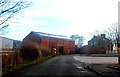
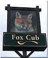
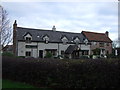
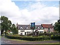
3
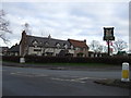
The Fox Cub, Little Hoole
Off Liverpool Road.
Image: © JThomas
Taken: 22 Nov 2014
0.08 miles
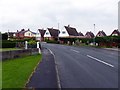
6
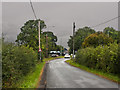
Dob Lane approaching the roundabout on the A59
Image: © Ian Greig
Taken: 13 Sep 2013
0.08 miles
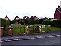
8
Inside Methodist Burial Ground, Much Hoole
Image: © Norman Caesar
Taken: 28 Jul 2016
0.10 miles
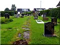
10
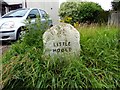
Boundary stone between Little Hoole and Much Hoole
Image: © Norman Caesar
Taken: 28 Jul 2016
0.14 miles