
IMAGES TAKEN NEAR TO
West Croft, PRESTON, PR4 4QP
Introduction
This page details the photographs taken nearby to West Croft, PR4 4QP by members of the Geograph project.
The Geograph project started in 2005 with the aim of publishing, organising and preserving representative images for every square kilometre of Great Britain, Ireland and the Isle of Man.

There are currently over 7.5m images from over14,400 individuals and you can help contribute to the project by visiting https://www.geograph.org.uk
Image Map
Images are licensed for reuse under creativecommons.org/licenses/by-sa/2.0
Notes
- Clicking on the map will re-center to the selected point.
- The higher the marker number, the further away the image location is from the centre of the postcode.
Image Listing (12 Images Found)
Images are licensed for reuse under creativecommons.org/licenses/by-sa/2.0
Image
Details
Distance
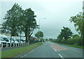
2
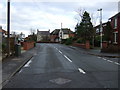
Liverpool Old Road, Much Hoole
Heading north east.
Image: © JThomas
Taken: 22 Nov 2014
0.09 miles
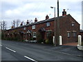
4
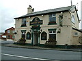
The Smithy Inn
On the corner of Smithy Lane & Liverpool Old Road
Image: © Peter Hodge
Taken: 17 Apr 2006
0.19 miles
5
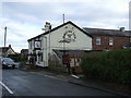
The Smithy Inn, Much Hoole
On Liverpool Old Road.
Image: © JThomas
Taken: 22 Nov 2014
0.20 miles
6
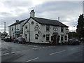
The Smithy Inn, Much Hoole
On Liverpool Old Road.
Image: © JThomas
Taken: 22 Nov 2014
0.21 miles
7
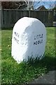
Old Boundary Marker by Liverpool Old Road, Much Hoole
Parish Boundary Marker by the UC road, in parish of Much Hoole (South Ribble District), Liverpool Old Road, junction with Birchfield on verge. Formerly on the boundary of Much Hoole and Little Hoole townships and, after 1886, parishes, but now entirely in Much Hoole due to a boundary change.
Inscription reads:-
: MUCH / HOOLE : : LITTLE / HOOLE :
Carved bench mark and pivot on top.
Surveyed
Milestone Society National ID: LA_MHOLHO01pb
Image: © Milestone Society
Taken: 1 Jan 2012
0.21 miles
8
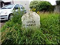
Boundary stone between Little Hoole and Much Hoole
Image: © Norman Caesar
Taken: 28 Jul 2016
0.21 miles
9
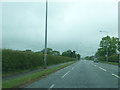
A59, Much Hoole
Where the road just crosses the bottom corner of the square.
Image: © Peter Bond
Taken: 31 May 2012
0.22 miles
10
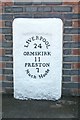
Old Milestone, Former A59, Liverpool Old Road, Much Hoole
The milestone is located by No.139, on the south side of the road. Parish of Much Hoole (South Ribble District). Metal plate attached to stone post, Liverpool plate design, erected by the Liverpool & Preston turnpike trust in the 19th century.
Inscription reads:-
LIVERPOOL
24
ORMSKIRK
11
PRESTON
7
Much Hoole
Grade II listed, List Entry Number: 1096125 https://historicengland.org.uk/listing/the-list/list-entry/1096125
Milestone Society National ID: LA_PSOK07
Image: © John Armstrong
Taken: Unknown
0.23 miles