IMAGES TAKEN NEAR TO
Royalty Gardens, PRESTON, PR4 4JW
Introduction
This page details the photographs taken nearby to Royalty Gardens, PR4 4JW by members of the Geograph project.
The Geograph project started in 2005 with the aim of publishing, organising and preserving representative images for every square kilometre of Great Britain, Ireland and the Isle of Man.

There are currently over 7.5m images from over14,400 individuals and you can help contribute to the project by visiting https://www.geograph.org.uk
Image Map
Images are licensed for reuse under creativecommons.org/licenses/by-sa/2.0
Notes
- Clicking on the map will re-center to the selected point.
- The higher the marker number, the further away the image location is from the centre of the postcode.
Image Listing (12 Images Found)
Images are licensed for reuse under creativecommons.org/licenses/by-sa/2.0
Image
Details
Distance
1
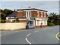
Bus Stop, Post Office and Newsagents, New Longton
New Longton is a pleasant, leafy village located 4 miles South West of Preston, in the district of South Ribble. It is part of the parish of Longton, which is the name of the older village located 2 miles to the west of New Longton.
New Longton is a relatively “new” village by local standards. Up until the late 19th century it was a collection of scattered farms and cottages. The village development was prompted by the building of the Preston to Southport railway line in 1873. A station called "Hutton and Howick" later renamed "New Longton and Hutton" was built at the junction of what is now Station Road and Chapel Lane. As with the rest of Britain the post war housing boom saw extensive expansion of the village housing stock from the 1940's onwards. The village lost its railway service with the line finally closing in 1967. Little trace of the line now exists.
New Longton is now a dormitory commuter village with a regular bus service into Longton and Preston and the M6, M61, M65 motorways are only four miles away. The surrounding area is mainly agricultural with mostly flat land now drained and cultivated known locally as 'the Moss'.
The village contains several shops, a Post Office, a Doctor's surgery, a school, two churches, two busy sports and social clubs and a nursing home.
http://allsaints.btck.co.uk/NewLongtonVillage All Saints’ New Longton
Image: © David Dixon
Taken: 12 Jul 2015
0.09 miles
2
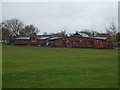
New Longton Cricket Club - Pavilion
The clubhouse at New Longton Sports & Social Club. The cricket section run three teams in the Palace Shield and a Sunday XI in the West Lancashire League.
Image: © BatAndBall
Taken: 6 Nov 2012
0.13 miles
3
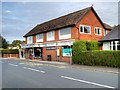
New Longton, Village Pharmacy
New Longton is a pleasant, leafy village located 4 miles South West of Preston, in the district of South Ribble. It is part of the parish of Longton, which is the name of the older village located 2 miles to the west of New Longton.
New Longton is a relatively “new” village by local standards. Up until the late 19th century it was a collection of scattered farms and cottages. The village development was prompted by the building of the Preston to Southport railway line in 1873. A station called "Hutton and Howick" later renamed "New Longton and Hutton" was built at the junction of what is now Station Road and Chapel Lane. As with the rest of Britain the post war housing boom saw extensive expansion of the village housing stock from the 1940's onwards. The village lost its railway service with the line finally closing in 1967. Little trace of the line now exists.
New Longton is now a dormitory commuter village with a regular bus service into Longton and Preston and the M6, M61, M65 motorways are only four miles away. The surrounding area is mainly agricultural with mostly flat land now drained and cultivated known locally as 'the Moss'.
The village contains several shops, a Post Office, a Doctor's surgery, a school, two churches, two busy sports and social clubs and a nursing home.
http://allsaints.btck.co.uk/NewLongtonVillage All Saints’ New Longton
Image: © David Dixon
Taken: 12 Jul 2015
0.15 miles
4
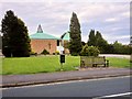
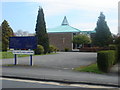
All Saints' Church, New Longton
All Saints' Church was founded in 1866., originally as a chapel housed in a rented cottage. A church was then built at the corner of Station Road and Hugh Barn Lane. This building now forms the old part of All Saints' Primary School.
The present church, on Station Road, dates from 1964.
http://allsaints.btck.co.uk/ church web site
Image: © David Dixon
Taken: 12 Jul 2015
0.16 miles
5
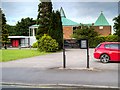
New Longton, All Saints' Church
All Saints' Church was founded in 1866., originally as a chapel housed in a rented cottage. A church was then built at the corner of Station Road and Hugh Barn Lane. This building now forms the old part of All Saints' Primary School.
The present church, on Station Road, dates from 1964.
http://allsaints.btck.co.uk/ church web site
Image: © David Dixon
Taken: 12 Jul 2015
0.16 miles
6
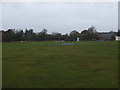
New Longton Cricket Club - Ground
Preparing for winter at New Longton CC's Chapel Lane ground.
Image: © BatAndBall
Taken: 6 Nov 2012
0.17 miles
7
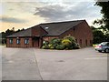
New Longton Village Hall
New Longton is a pleasant, leafy village located 4 miles South West of Preston, in the district of South Ribble. It is part of the parish of Longton, which is the name of the older village located 2 miles to the west of New Longton.
New Longton is a relatively “new” village by local standards. Up until the late 19th century it was a collection of scattered farms and cottages. The village development was prompted by the building of the Preston to Southport railway line in 1873. A station called "Hutton and Howick" later renamed "New Longton and Hutton" was built at the junction of what is now Station Road and Chapel Lane. As with the rest of Britain the post war housing boom saw extensive expansion of the village housing stock from the 1940's onwards. The village lost its railway service with the line finally closing in 1967. Little trace of the line now exists.
New Longton is now a dormitory commuter village with a regular bus service into Longton and Preston and the M6, M61, M65 motorways are only four miles away. The surrounding area is mainly agricultural with mostly flat land now drained and cultivated known locally as 'the Moss'.
The village contains several shops, a Post Office, a Doctor's surgery, a school, two churches, two busy sports and social clubs and a nursing home.
http://allsaints.btck.co.uk/NewLongtonVillage All Saints’ New Longton
Image: © David Dixon
Taken: 12 Jul 2015
0.17 miles
8
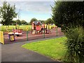
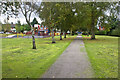
New Longton Children's Playground
New Longton is a pleasant, leafy village located 4 miles South West of Preston, in the district of South Ribble. It is part of the parish of Longton, which is the name of the older village located 2 miles to the west of New Longton.
New Longton is a relatively “new” village by local standards. Up until the late 19th century it was a collection of scattered farms and cottages. The village development was prompted by the building of the Preston to Southport railway line in 1873. A station called "Hutton and Howick" later renamed "New Longton and Hutton" was built at the junction of what is now Station Road and Chapel Lane. As with the rest of Britain the post war housing boom saw extensive expansion of the village housing stock from the 1940's onwards. The village lost its railway service with the line finally closing in 1967. Little trace of the line now exists.
New Longton is now a dormitory commuter village with a regular bus service into Longton and Preston and the M6, M61, M65 motorways are only four miles away. The surrounding area is mainly agricultural with mostly flat land now drained and cultivated known locally as 'the Moss'.
The village contains several shops, a Post Office, a Doctor's surgery, a school, two churches, two busy sports and social clubs and a nursing home.
http://allsaints.btck.co.uk/NewLongtonVillage All Saints’ New Longton
Image: © David Dixon
Taken: 12 Jul 2015
0.18 miles