IMAGES TAKEN NEAR TO
Chapel Lane, PRESTON, PR4 4AD
Introduction
This page details the photographs taken nearby to Chapel Lane, PR4 4AD by members of the Geograph project.
The Geograph project started in 2005 with the aim of publishing, organising and preserving representative images for every square kilometre of Great Britain, Ireland and the Isle of Man.

There are currently over 7.5m images from over14,400 individuals and you can help contribute to the project by visiting https://www.geograph.org.uk
Image Map
Images are licensed for reuse under creativecommons.org/licenses/by-sa/2.0
Notes
- Clicking on the map will re-center to the selected point.
- The higher the marker number, the further away the image location is from the centre of the postcode.
Image Listing (11 Images Found)
Images are licensed for reuse under creativecommons.org/licenses/by-sa/2.0
Image
Details
Distance
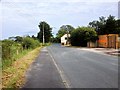
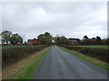
2
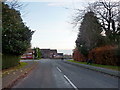
Junction of Saunders' Lane and Chapel Lane, New Longton
Image: © Alexander P Kapp
Taken: 24 Nov 2010
0.15 miles
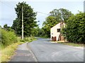
8
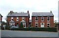
New House equestrian centre
in what looks to have been Brookfield Farm.
Image: © Margaret Clough
Taken: 24 Apr 2006
0.23 miles
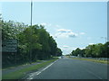
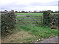
9
Brownhill Lane, Longton
Looking south east on the flat.
Image: © JThomas
Taken: 25 Oct 2018
0.23 miles
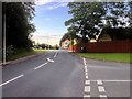
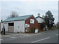
10

Longton Bypass (A59) crossing Chapel Park Road, New Longton
Bridge carrying the Longton Bypass (A59).
Image: © David Dixon
Taken: 12 Jul 2015
0.24 miles