IMAGES TAKEN NEAR TO
Mowbreck Lane, PRESTON, PR4 3HU
Introduction
This page details the photographs taken nearby to Mowbreck Lane, PR4 3HU by members of the Geograph project.
The Geograph project started in 2005 with the aim of publishing, organising and preserving representative images for every square kilometre of Great Britain, Ireland and the Isle of Man.

There are currently over 7.5m images from over14,400 individuals and you can help contribute to the project by visiting https://www.geograph.org.uk
Image Map
Images are licensed for reuse under creativecommons.org/licenses/by-sa/2.0
Notes
- Clicking on the map will re-center to the selected point.
- The higher the marker number, the further away the image location is from the centre of the postcode.
Image Listing (18 Images Found)
Images are licensed for reuse under creativecommons.org/licenses/by-sa/2.0
Image
Details
Distance
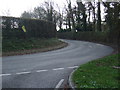
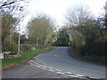
3
Junction at the northern end of Carr Lane
Moorside to the left, Kirkham Road to the right.
Image: © Barbara Carr
Taken: 7 Nov 2013
0.04 miles
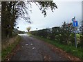
4
Crossroads and 24 metre spot height, west of Treales
Looking east from Mowbreck Lane.
Image: © Christine Johnstone
Taken: 5 Oct 2015
0.05 miles
6
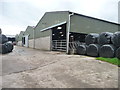
Cattle sheds, Church View Farm
This farm is not on my 2000 OS map.
Image: © Christine Johnstone
Taken: 5 Oct 2015
0.06 miles
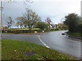
7
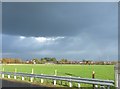
Louring skies with a hint of a rainbow over Treales
Looking eastward from Carr Lane.
Image: © Barbara Carr
Taken: 7 Nov 2013
0.10 miles
8
![Large field, north side of Mowbreck Lane [1]](https://s3.geograph.org.uk/geophotos/04/68/95/4689551_608923b3_120x120.jpg)
Large field, north side of Mowbreck Lane [1]
Looking north-east towards Moorside.
Image: © Christine Johnstone
Taken: 5 Oct 2015
0.10 miles
9
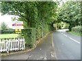
Protest signs, Kirkham Road, Treales
The village is dotted with both the simple 'no fracking' signs and the more subtle 'Not for shale' mock estate agents' boards.
Image: © Christine Johnstone
Taken: 5 Oct 2015
0.12 miles
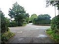
10
![Large field, north of Mowbreck Lane [2]](https://s1.geograph.org.uk/geophotos/04/68/95/4689553_5227634b_120x120.jpg)
Large field, north of Mowbreck Lane [2]
Looking north-west, from a field gate.
Image: © Christine Johnstone
Taken: 5 Oct 2015
0.13 miles