
IMAGES TAKEN NEAR TO
Wray Crescent, PRESTON, PR4 2WA
Introduction
This page details the photographs taken nearby to Wray Crescent, PR4 2WA by members of the Geograph project.
The Geograph project started in 2005 with the aim of publishing, organising and preserving representative images for every square kilometre of Great Britain, Ireland and the Isle of Man.

There are currently over 7.5m images from over14,400 individuals and you can help contribute to the project by visiting https://www.geograph.org.uk
Image Map
Images are licensed for reuse under creativecommons.org/licenses/by-sa/2.0
Notes
- Clicking on the map will re-center to the selected point.
- The higher the marker number, the further away the image location is from the centre of the postcode.
Image Listing (10 Images Found)
Images are licensed for reuse under creativecommons.org/licenses/by-sa/2.0
Image
Details
Distance
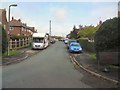
2
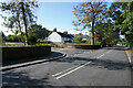
Malcolm's Place
Malcolm's Place is a cul-de-sac of fairly modern houses between Ribby Hall and Wrea Green.
Image: © Malcolm Neal
Taken: 26 Sep 2021
0.09 miles
3
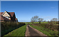
Footpath - track
A long way round to Stable Wood
Image: © Ian Greig
Taken: 31 Mar 2017
0.09 miles
4
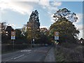
The B5259 into Wrea Green
Travelling west into the village.
Image: © Barbara Carr
Taken: 10 Nov 2013
0.12 miles
8
Ribby Road
The road is quiet because there are road works behind us that are completely blocking the road.
Image: © Malcolm Neal
Taken: 26 Sep 2021
0.19 miles
9
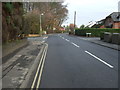
Ribby Road (B5259), Wrea Green
Heading east.
Image: © JThomas
Taken: 15 Nov 2014
0.20 miles
10
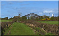
Footpath - track
The look of the going is deceptive. The clue is the level of water in the ditches on either side of the track. Just standing taking this shot I sank into 2" of mud.
Image: © Ian Greig
Taken: 31 Mar 2017
0.21 miles