IMAGES TAKEN NEAR TO
Vulcan Road, PRESTON, PR4 1JN
Introduction
This page details the photographs taken nearby to Vulcan Road, PR4 1JN by members of the Geograph project.
The Geograph project started in 2005 with the aim of publishing, organising and preserving representative images for every square kilometre of Great Britain, Ireland and the Isle of Man.

There are currently over 7.5m images from over14,400 individuals and you can help contribute to the project by visiting https://www.geograph.org.uk
Image Map
Images are licensed for reuse under creativecommons.org/licenses/by-sa/2.0
Notes
- Clicking on the map will re-center to the selected point.
- The higher the marker number, the further away the image location is from the centre of the postcode.
Image Listing (12 Images Found)
Images are licensed for reuse under creativecommons.org/licenses/by-sa/2.0
Image
Details
Distance
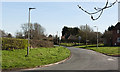
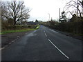
3
Anson Road, Kirkham
At the junction with Lower Lane.
Image: © Barbara Carr
Taken: 7 Nov 2013
0.16 miles
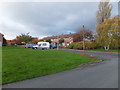
5
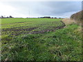
Emerging crop
Farmland to the west of Lower Lane.
Image: © Barbara Carr
Taken: 7 Nov 2013
0.22 miles
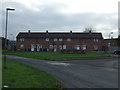
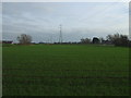
6

Junction of Hillock Lane and Kirkham Road
Image: © Barbara Carr
Taken: 23 Oct 2013
0.22 miles
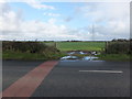
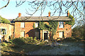
10
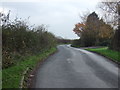
Lower Lane
Heading south near Swimza Butts Farm.
Image: © JThomas
Taken: 15 Nov 2014
0.24 miles