IMAGES TAKEN NEAR TO
Rosbery Close, PRESTON, PR4 1FN
Introduction
This page details the photographs taken nearby to Rosbery Close, PR4 1FN by members of the Geograph project.
The Geograph project started in 2005 with the aim of publishing, organising and preserving representative images for every square kilometre of Great Britain, Ireland and the Isle of Man.

There are currently over 7.5m images from over14,400 individuals and you can help contribute to the project by visiting https://www.geograph.org.uk
Image Map
Images are licensed for reuse under creativecommons.org/licenses/by-sa/2.0
Notes
- Clicking on the map will re-center to the selected point.
- The higher the marker number, the further away the image location is from the centre of the postcode.
Image Listing (23 Images Found)
Images are licensed for reuse under creativecommons.org/licenses/by-sa/2.0
Image
Details
Distance
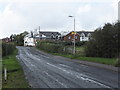
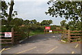
1
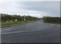
Hillock Lane
Looking northwesterly from the junction with the road from Warton.
Image: © Barbara Carr
Taken: 23 Oct 2013
0.05 miles
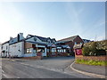
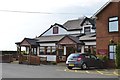
2
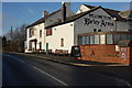
Birley Arms
The Birley family were important landowners in the 19th century in the Fylde area.
Image: © Keith Wright
Taken: 19 Dec 2005
0.07 miles
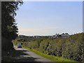
3
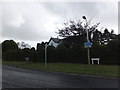
At the western end of Hillock Lane
The road southeasterly to Warton is known as Church Road, and northwesterly into Kellamergh it's called Bryining Lane.
Image: © Barbara Carr
Taken: 23 Oct 2013
0.07 miles
4
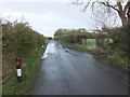
Surplus water on Hillock Lane
The heavy rain of the previous day draining off the fields onto Hillock Lane.
Image: © Barbara Carr
Taken: 23 Oct 2013
0.09 miles
5
Bryning Lane and the Birley Arms Hotel
Approaching the little village of Kellamergh.
Image: © Barbara Carr
Taken: 23 Oct 2013
0.11 miles
6
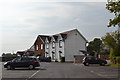
The Birley Arms Accommodation Block and Car Park, Bryning Lane, Warton
Image: © Terry Robinson
Taken: 1 Oct 2013
0.12 miles
9
AFC Fylde Ground, Kellamergh Park, Bryning Lane, Warton
The club was founded in 1988 as Kirkham & Wesham FC ... with Kirkham being approx 3 miles away.
In order to develop the club it moved to Kellammergh Park in 2006 ...
...and changed its name to AFC Fylde in 2008
See also ...
Image
Image
Image
Image
Image: © Terry Robinson
Taken: 1 Oct 2013
0.13 miles
10
The Birley Arms, Bryning Lane, Warton
This is the side view and entrance to the pub and attached accommodation block ... see ...
Image
Image: © Terry Robinson
Taken: 1 Oct 2013
0.13 miles