
IMAGES TAKEN NEAR TO
Head Dyke Lane, PRESTON, PR3 6SJ
Introduction
This page details the photographs taken nearby to Head Dyke Lane, PR3 6SJ by members of the Geograph project.
The Geograph project started in 2005 with the aim of publishing, organising and preserving representative images for every square kilometre of Great Britain, Ireland and the Isle of Man.

There are currently over 7.5m images from over14,400 individuals and you can help contribute to the project by visiting https://www.geograph.org.uk
Image Map
Images are licensed for reuse under creativecommons.org/licenses/by-sa/2.0
Notes
- Clicking on the map will re-center to the selected point.
- The higher the marker number, the further away the image location is from the centre of the postcode.
Image Listing (11 Images Found)
Images are licensed for reuse under creativecommons.org/licenses/by-sa/2.0
Image
Details
Distance
2
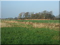
Farmland towards Heys Meadow Wood
North of Head Dyke Lane.
Image: © JThomas
Taken: 29 Nov 2014
0.10 miles
3
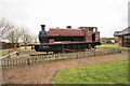
The Pilling Pig
"The Pilling Pig" was the nickname of one of the locomotives on the Garstang to Knott End Railway, allegedly because the sound of its whistle resembled a dying pig. The nickname is often used to describe the railway in general, which was very much a locally run affair, the train stopping on demand almost anywhere. It was never a real financial success, and for some time the carriages had to be pulled by horses because the locomotive was repossessed by the hire purchase company.
This loco now adorns the entrance to a caravan park.
Image: © Bob Jenkins
Taken: 16 Feb 2009
0.11 miles
4
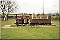
The Pilling Piglet
Set in front of "The Pilling Pig" is this amusing model, at the entrance to Ascot Park and Home Park, mobile holiday home centres which straddle the old railway.
Image: © Bob Jenkins
Taken: 16 Feb 2009
0.11 miles
5
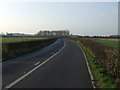
Head Dyke Lane (A588)
Heading south west towards Stalmine.
Image: © JThomas
Taken: 29 Nov 2014
0.13 miles
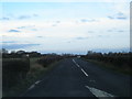
7
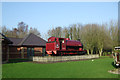
The Pilling Pig
Preserved steam loco stands in the grounds of a holiday park. The Garstang and Knot-End Railway used to run in this location.
Image: © JThomas
Taken: 29 Nov 2014
0.16 miles
8
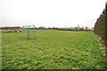
Playing Field at Stakepool
Newly established behind the caravan site, a diverted public footpath runs along the western edge.
Image: © Bob Jenkins
Taken: 16 Feb 2009
0.16 miles
9
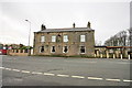
Elletson Arms, Stake Pool
Originally called the Gardeners Arms, this inn at Stake Pool took its present name when John Gardner bequeathed his share of the manor of Pilling to his nieces, Margaret Jane and Emily Elletson. The original front door is now the second window from the left.
Image: © Bob Jenkins
Taken: 16 Feb 2009
0.23 miles
10
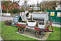
Railway Handcart
The initials stand for "Garstang and Knot End Railway". Knot was the original spelling of the company, now better known as having two "t"s.
Image: © Bob Jenkins
Taken: 5 Mar 2009
0.24 miles