IMAGES TAKEN NEAR TO
Smallwood Hey Road, PRESTON, PR3 6HJ

Introduction

This page details the photographs taken nearby to Smallwood Hey Road, PR3 6HJ by members of the Geograph project.

The Geograph project started in 2005 with the aim of publishing, organising and preserving representative images for every square kilometre of Great Britain, Ireland and the Isle of Man.

There are currently over 7.5m images from over14,400 individuals and you can help contribute to the project by visiting https://www.geograph.org.uk

Image Map


Images are licensed for reuse under creativecommons.org/licenses/by-sa/2.0
Notes
  • Clicking on the map will re-center to the selected point.
  • The higher the marker number, the further away the image location is from the centre of the postcode.

Image Listing (9 Images Found)

Images are licensed for reuse under creativecommons.org/licenses/by-sa/2.0
Image
Details
Distance
1
Smallwood Hey Road from Pilling
Image: © Steve Daniels Taken: 27 Aug 2014
0.01 miles
2
Smallwood Hey Road leaving Pilling
Image: © Steve Daniels Taken: 27 Aug 2014
0.12 miles
3
Smallwood Hey Road from Pilling
Image: © Steve Daniels Taken: 27 Aug 2014
0.13 miles
4
Smallwood Hey Road
Heading east.
Image: © JThomas Taken: 29 Nov 2014
0.18 miles
5
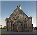
Pilling Methodist Chapel and Sunday School
The memorial stone was laid 10 Aug 1892, the chapel being declared open for public worship on 13 Jun 1894. The pioneer of Wesleyan Methodism in Pilling was Richard Mason born 1780, a close relative by marriage of the builder of Damside Mill.
Image: © Bob Jenkins Taken: 18 Nov 2008
0.18 miles
6
Pilling Methodist Church
Image: © Ian Greig Taken: 9 Oct 2018
0.22 miles
7
Ordnance Survey Cut Mark
This OS cut mark can be found on the chapel. It marks a point 5.663m above mean sea level.
Image: © Adrian Dust Taken: 4 Apr 2014
0.22 miles
8
Cottages on Wheel Lane, Smallwood Hey
Image: © Bob Jenkins Taken: 16 Feb 2009
0.24 miles
9
The junction of Hooles Lane, Wheel Lane and Smallwood Hey Road
Image: © Ian Greig Taken: 9 Oct 2018
0.25 miles