1
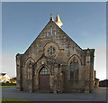
Ordnance Survey Cut Mark
This OS cut mark can be found on the chapel. It marks a point 5.663m above mean sea level.
Image: © Adrian Dust
Taken: 4 Apr 2014
0.10 miles
2
Pilling Methodist Church
Image: © Ian Greig
Taken: 9 Oct 2018
0.11 miles
3
Smallwood Hey Road from Pilling
Image: © Steve Daniels
Taken: 27 Aug 2014
0.13 miles
4
Two Wheeled Iron Unicorn
It's an advertising feature for Pilling Pottery
Image: © Bob Jenkins
Taken: 18 Nov 2008
0.13 miles
5
The Old Church of St John the Baptist, Pilling
Looking towards the 'new' church. No longer used for worship https://en.wikipedia.org/wiki/Old_St_John_the_Baptist%27s_Church,_Pilling .
Image: © Karl and Ali
Taken: 12 Jun 2018
0.13 miles
6
Pilling Methodist Chapel and Sunday School
The memorial stone was laid 10 Aug 1892, the chapel being declared open for public worship on 13 Jun 1894. The pioneer of Wesleyan Methodism in Pilling was Richard Mason born 1780, a close relative by marriage of the builder of Damside Mill.
Image: © Bob Jenkins
Taken: 18 Nov 2008
0.16 miles
7
Pilling Reading Room
Image: © Bob Jenkins
Taken: 18 Nov 2008
0.16 miles
8
Cheesy Advert
One presumes it's advertising local cheese, and is not a description of the county.
Image: © Bob Jenkins
Taken: 18 Nov 2008
0.16 miles
9
The Parish of St John the Baptist, Pilling, Path
The path goes from the church to the cemetery
Image: © Alexander P Kapp
Taken: 28 Oct 2009
0.17 miles
10
The Old Ship, Pilling
The Old Ship is a residential property in the village of Pilling, in Lancashire, England. It is Grade II listed, joining English Heritage's list of protected buildings on 17 April 1967.
Also known as "The Olde Ship" and "The Ship Inn", it was originally constructed in 1782 for George Dickinson.
George Dickinson was born in Pilling in 1732. He was drawn west out to the sea rather than to the surrounding farmlands by the Wyre and Fylde - he was Captain of various trans-Atlantic slave ships. Records show that a George Dickinson sailed several times from Liverpool to the Windward Coast of west Africa during the 18th century.
His pursuits granted him considerable wealth, and, upon his retirement, enabled him to purchase Hooles Farm and construct The Old Ship. He married Ann "Nancy" Whiteside, who was also native to Pilling, and there is reference to George and Nancy on site - in the yard is a pump inscribed with their initials.
As an elderly yeoman of Pilling, George allowed The Old Ship to be used for local village politics, for instance as a base for the Court Baron and magistrates.
The Old Ship passed to various persons and families after his death in 1806 - the Whitesides, the Armers, the Lewins, the Ronsons, and Edmonsons - and has been used variously as a hotel, inn, pub, restaurant, and private home. However it was probably best known as an isolated tavern that was strategically located to support smuggling in the early 19th century.
It was renovated in 2011, with the original brickwork restored to the front façade.
Image: © Steven Haslington
Taken: 21 Mar 2015
0.18 miles


