IMAGES TAKEN NEAR TO
Dilworth Bottoms, PRESTON, PR3 3ZB
Introduction
This page details the photographs taken nearby to Dilworth Bottoms, PR3 3ZB by members of the Geograph project.
The Geograph project started in 2005 with the aim of publishing, organising and preserving representative images for every square kilometre of Great Britain, Ireland and the Isle of Man.

There are currently over 7.5m images from over14,400 individuals and you can help contribute to the project by visiting https://www.geograph.org.uk
Image Map (Loading...)


Getting Data...Please wait
Leaflet Map data © OpenStreetMap
Images are licensed for reuse under creativecommons.org/licenses/by-sa/2.0
Notes
- Clicking on the map will re-center to the selected point.
- The higher the marker number, the further away the image location is from the centre of the postcode.
Image Listing (24 Images Found)
Images are licensed for reuse under creativecommons.org/licenses/by-sa/2.0
Image
Details
Distance
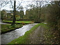
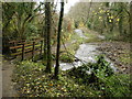
1

Ford at Ward Green
This ford on the Cowley Brook is found beside White Carr Farm at Ward Green.
Image: © John Walton
Taken: 16 Nov 2014
0.02 miles
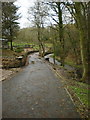
3
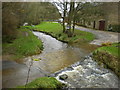
Ford on Cowley Brook at White Carr Farm
Image: © Alexander P Kapp
Taken: 24 Nov 2009
0.04 miles
4
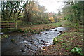
Ford at Ward Green
This is a second ford on the Cowley Beck at Ward Green.
Image: © John Walton
Taken: 16 Nov 2014
0.05 miles
6
Confluence
Of Page Brook and Cowley Brook
Image: © Alexander P Kapp
Taken: 24 Nov 2009
0.08 miles
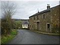
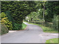
7
Road near Springs Farm, Dilworth Bottoms
Image: © Alexander P Kapp
Taken: 24 Nov 2009
0.12 miles
8
Ward Green Lane, Ward Green Cross
Looking north.
Image: © JThomas
Taken: 24 Sep 2016
0.13 miles
9
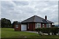
Bungalow on Ward Green Lane
East of Longridge.
Image: © philandju
Taken: 21 Sep 2022
0.13 miles
10
Ward Green
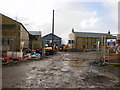
In the throws of conversion to a school.
Image: © Alexander P Kapp
Taken: 5 Nov 2009
0.14 miles