
IMAGES TAKEN NEAR TO
Short Lane, PRESTON, PR3 2JN
Introduction
This page details the photographs taken nearby to Short Lane, PR3 2JN by members of the Geograph project.
The Geograph project started in 2005 with the aim of publishing, organising and preserving representative images for every square kilometre of Great Britain, Ireland and the Isle of Man.

There are currently over 7.5m images from over14,400 individuals and you can help contribute to the project by visiting https://www.geograph.org.uk
Image Map
Images are licensed for reuse under creativecommons.org/licenses/by-sa/2.0
Notes
- Clicking on the map will re-center to the selected point.
- The higher the marker number, the further away the image location is from the centre of the postcode.
Image Listing (7 Images Found)
Images are licensed for reuse under creativecommons.org/licenses/by-sa/2.0
Image
Details
Distance
2
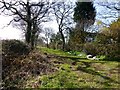
Bridleway Towards Barton House
A bridleway off the minor road which heads towards Barton House.
Image: © Rude Health
Taken: 16 Apr 2013
0.09 miles
6
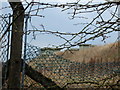
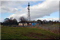
UKWMO Wartime Headquarters
The United Kingdom Warning and Monitoring Organization (UKWMO) was the successor to the Royal Observer Corps in the warning of the public and also the Government and Military, of a nuclear attack against the UK. This bunker in Goosenargh is where the infamous "Attack Warning Red" would have been broadcast from, after the Ballistic Missile Early Warning System (BMEWS) on Fylingdales Moor picked up the inbound missiles. Another relic of man's most dangerous time on earth and Cold War relic left to rot away.
Image: © Saul Beeson
Taken: 11 Mar 2006
0.22 miles
7
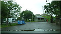
UKWMO and ROC HQ no 21, Wartime bunkers
On Langly Lane, Goosenagh.
Image: © Peter Bond
Taken: 11 Aug 2011
0.22 miles