IMAGES TAKEN NEAR TO
Bleasdale Road, PRESTON, PR3 2AR
Introduction
This page details the photographs taken nearby to Bleasdale Road, PR3 2AR by members of the Geograph project.
The Geograph project started in 2005 with the aim of publishing, organising and preserving representative images for every square kilometre of Great Britain, Ireland and the Isle of Man.

There are currently over 7.5m images from over14,400 individuals and you can help contribute to the project by visiting https://www.geograph.org.uk
Image Map
Images are licensed for reuse under creativecommons.org/licenses/by-sa/2.0
Notes
- Clicking on the map will re-center to the selected point.
- The higher the marker number, the further away the image location is from the centre of the postcode.
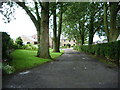
Image Listing (7 Images Found)
Images are licensed for reuse under creativecommons.org/licenses/by-sa/2.0
Image
Details
Distance
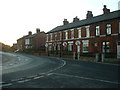
3
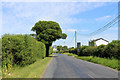
Carnforth Hall Lane
Heading east from Cumeragh Village
Image: © Chris Heaton
Taken: 2 Jun 2020
0.16 miles
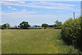
5
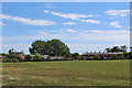
Approaching Cumeragh Village
Public footpath from Goosnargh follows the edge of this field to reach Cumeragh Village
Image: © Chris Heaton
Taken: 2 Jun 2020
0.20 miles