IMAGES TAKEN NEAR TO
Trent Street, PRESTON, PR3 2AH
Introduction
This page details the photographs taken nearby to Trent Street, PR3 2AH by members of the Geograph project.
The Geograph project started in 2005 with the aim of publishing, organising and preserving representative images for every square kilometre of Great Britain, Ireland and the Isle of Man.

There are currently over 7.5m images from over14,400 individuals and you can help contribute to the project by visiting https://www.geograph.org.uk
Image Map (Loading...)


Getting Data...Please wait
Leaflet Map data © OpenStreetMap
Images are licensed for reuse under creativecommons.org/licenses/by-sa/2.0
Notes
- Clicking on the map will re-center to the selected point.
- The higher the marker number, the further away the image location is from the centre of the postcode.
Image Listing (15 Images Found)
Images are licensed for reuse under creativecommons.org/licenses/by-sa/2.0
Image
Details
Distance
1
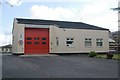
Longridge fire station
Longridge fire station, Whittingham Road, Longridge, Lancashire
Image: © Kevin Hale
Taken: 28 May 2010
0.07 miles
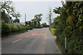
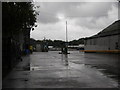
3
Stone Bridge, Longridge
Built in 1847 to span the Preston to Longridge railway. The line was closed to passenger traffic in 1930, and completely in 1967. The road ahead is the B6244 Preston Road, the one coming from the right the B5269 Whittingham Road.
Image: © M J Richardson
Taken: 27 Jun 2010
0.10 miles
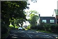
4
Whittingham Road, Longridge
B5269 heading west out of Longridge
Image: © Chris Heaton
Taken: 2 Jun 2020
0.12 miles
5
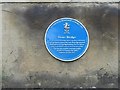
Stone Bridge information plaque
Provided by the Longridge Heritage Committee.
Image: © M J Richardson
Taken: 27 Jun 2010
0.14 miles
6
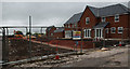
House building - Cromwell Heights
Oliver Cromwell’s name was associated with Longridge following his civil war engagements with Royalist forces nearby. There is even an apocryphal tale that he is responsible for the town’s name.
Image: © Ian Greig
Taken: 22 May 2015
0.14 miles
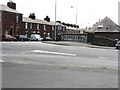
7
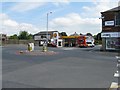
Keston Lane
The B5269, at its junction with Preston Road at Stone Bridge.
Image: © M J Richardson
Taken: 27 Jun 2010
0.15 miles
10
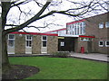
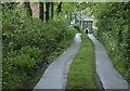
Longridge High School
The main entrance at Longridge High School.
Image: © Chris Preston
Taken: 1 Feb 2006
0.18 miles