
IMAGES TAKEN NEAR TO
Strickens Lane, PRESTON, PR3 1UE
Introduction
This page details the photographs taken nearby to Strickens Lane, PR3 1UE by members of the Geograph project.
The Geograph project started in 2005 with the aim of publishing, organising and preserving representative images for every square kilometre of Great Britain, Ireland and the Isle of Man.

There are currently over 7.5m images from over14,400 individuals and you can help contribute to the project by visiting https://www.geograph.org.uk
Image Map
Images are licensed for reuse under creativecommons.org/licenses/by-sa/2.0
Notes
- Clicking on the map will re-center to the selected point.
- The higher the marker number, the further away the image location is from the centre of the postcode.
Image Listing (14 Images Found)
Images are licensed for reuse under creativecommons.org/licenses/by-sa/2.0
Image
Details
Distance
2
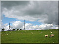
Sheep grazing at Bank Farm
Below the three telecoms masts on Barnacre Moor.
Image: © Karl and Ali
Taken: 17 Jun 2012
0.07 miles
3
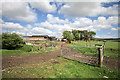
Bank Farm
The actual farmhouse is hidden behind the outbuildings and accessories.
Image: © Bob Jenkins
Taken: 7 May 2009
0.09 miles
4
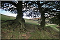
Old Trees With Root Erosion
Appears to be part of an old boundary hedge, long neglected. Wind, rain and sheep have caused soil erosion round the roots.
Image: © Bob Jenkins
Taken: 1 Nov 2008
0.14 miles
5
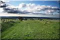
Footpath off Barnacre Moor
Appears to have had considerable more importance in past times, linking Oakenclough with Garstang. The Fylde lies beyond
Image: © Bob Jenkins
Taken: 1 Nov 2008
0.15 miles
6
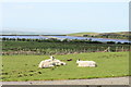
Grazing Above Barnacre Reservoir
Taken from the track leading to the transmitters on the hill summit behind.
Image: © Bob Jenkins
Taken: 7 May 2009
0.15 miles
7
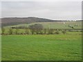
Grass fields above Calder Vale
A view towards Oakenclough Fell.
Image: © Richard Webb
Taken: 23 Dec 2012
0.17 miles
8
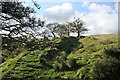
Old Wall Above Oakenclough
With the wet lane to the left, and a rivulet to the right, the old wall provides a dry alternative for the footpath.
Image: © Bob Jenkins
Taken: 1 Nov 2008
0.17 miles
10
Road to Oakenclough
Stake House Fell on the horizon
Image: © Michael Graham
Taken: 24 Jul 2009
0.21 miles