IMAGES TAKEN NEAR TO
Devonshire Drive, PRESTON, PR3 1HN
Introduction
This page details the photographs taken nearby to Devonshire Drive, PR3 1HN by members of the Geograph project.
The Geograph project started in 2005 with the aim of publishing, organising and preserving representative images for every square kilometre of Great Britain, Ireland and the Isle of Man.

There are currently over 7.5m images from over14,400 individuals and you can help contribute to the project by visiting https://www.geograph.org.uk
Image Map (Loading...)


Getting Data...Please wait
Leaflet Map data © OpenStreetMap
Images are licensed for reuse under creativecommons.org/licenses/by-sa/2.0
Notes
- Clicking on the map will re-center to the selected point.
- The higher the marker number, the further away the image location is from the centre of the postcode.
Image Listing (57 Images Found)
Images are licensed for reuse under creativecommons.org/licenses/by-sa/2.0
Image
Details
Distance
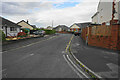
1
Site of former Garstang Town station, 1996
View northward on Coston Road at Station Way. The station had been to the right, on the ex-LNWR Garstang & Catterall (to right) - (to left) Knott End branch, which closed to passengers 31/3/30, to goods 13/11/50.
Image: © Ben Brooksbank
Taken: 26 Jun 1996
0.07 miles
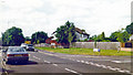
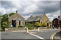
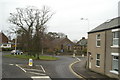
3
Sussex Drive
A residential road in easy reach of the centre of Garstang.
Image: © Bill Boaden
Taken: 9 Sep 2022
0.12 miles
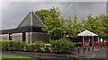
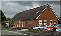
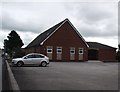
5
Free Methodist Church
Not an independent Methodist church but part of a separate denomination founded in 1860.
Image: © Bill Boaden
Taken: 9 Sep 2022
0.14 miles
6
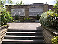
The War Memorial, Croston Weind, Garstang
A plain memorial, just the plaques mounted on a stone wall.
Image: © Humphrey Bolton
Taken: 14 May 2007
0.14 miles
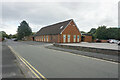
7
The Congregational Chapel and Sunday School, Croston Weind, Garstang
The chapel (now United Reformed Church) is early 19C, but the Sunday School on the right much later; it is dated 1903. Weind is the local name for the alleys between the High Street and the Back Lane; although in this case it is a road rather than an alley.
Image: © Humphrey Bolton
Taken: 14 May 2007
0.14 miles
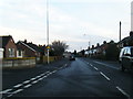
8
The road out of Garstang, to the north
From the top deck of the No.40, Preston-Morecambe bus.
Image: © David Long
Taken: 23 Dec 2008
0.14 miles
9
Free Methodist Church, Garstang
On Windsor Road.
Image: © philandju
Taken: 23 Jul 2012
0.15 miles