IMAGES TAKEN NEAR TO
Black Lane, PRESTON, PR3 0LH
Introduction
This page details the photographs taken nearby to Black Lane, PR3 0LH by members of the Geograph project.
The Geograph project started in 2005 with the aim of publishing, organising and preserving representative images for every square kilometre of Great Britain, Ireland and the Isle of Man.

There are currently over 7.5m images from over14,400 individuals and you can help contribute to the project by visiting https://www.geograph.org.uk
Image Map
Images are licensed for reuse under creativecommons.org/licenses/by-sa/2.0
Notes
- Clicking on the map will re-center to the selected point.
- The higher the marker number, the further away the image location is from the centre of the postcode.
Image Listing (8 Images Found)
Images are licensed for reuse under creativecommons.org/licenses/by-sa/2.0
Image
Details
Distance
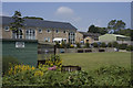
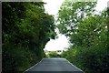
1
Station Lane, Nateby
Further up the lane there is the site of a station, there is now little sign of the railway. There is a small wood on the corner.
Image: © Richard Webb
Taken: 23 Oct 2016
0.11 miles
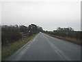
3
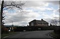
Black Lane by the junction with Station Lane
Image: © Peter Bond
Taken: 13 Mar 2011
0.12 miles
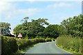
4
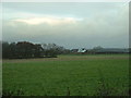
Farmland near Nateby
Looking northeast. The white building is Elm Farm, which used to be a station [a halt, presumably]on the Garstang to Knott End railway
Image: © David Medcalf
Taken: 4 Dec 2005
0.13 miles
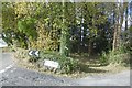
5
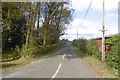
Station Lane, Nateby
No through road, it once served Nateby Station on the Knot End Railway, long since closed.
Image: © Richard Webb
Taken: 23 Oct 2016
0.14 miles