IMAGES TAKEN NEAR TO
Tan Yard Road, PRESTON, PR3 0HP
Introduction
This page details the photographs taken nearby to Tan Yard Road, PR3 0HP by members of the Geograph project.
The Geograph project started in 2005 with the aim of publishing, organising and preserving representative images for every square kilometre of Great Britain, Ireland and the Isle of Man.

There are currently over 7.5m images from over14,400 individuals and you can help contribute to the project by visiting https://www.geograph.org.uk
Image Map (Loading...)


Getting Data...Please wait
Leaflet Map data © OpenStreetMap
Images are licensed for reuse under creativecommons.org/licenses/by-sa/2.0
Notes
- Clicking on the map will re-center to the selected point.
- The higher the marker number, the further away the image location is from the centre of the postcode.
Image Listing (13 Images Found)
Images are licensed for reuse under creativecommons.org/licenses/by-sa/2.0
Image
Details
Distance
3
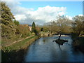
Mill House, Kirkland
On the River Wyre, near Garstang
Image: © David Medcalf
Taken: 12 Nov 2005
0.10 miles
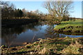
4
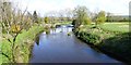
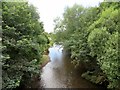
River Wyre
This is a view of the River Wyre as taken from the Kirkland Bridge.
Image: © Rude Health
Taken: 14 Apr 2014
0.11 miles
5
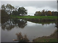
Confluence of the Calder and Wyre
The Calder flows in from the east joining the larger Wyre.
Image: © Karl and Ali
Taken: 25 Oct 2018
0.11 miles
6
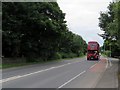
Wedding bus
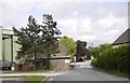
A vintage bus carrying a wedding party up the A6.
Image: © philandju
Taken: 21 Jul 2016
0.12 miles
7
Where Calder and Wyre meet
The river Calder -on right joins the river Wyre above Churchtown.
Image: © Peter Bond
Taken: 31 Jan 2010
0.13 miles
8
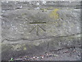
Ordnance Survey Cut Mark
This OS cut mark can be found on the SW parapet of Kirkland Bridge. It marks a point 14.060m above mean sea level.
Image: © Adrian Dust
Taken: 6 Apr 2014
0.14 miles
9
River Wyre
From Kirkland Bridge on the A6.
Image: © philandju
Taken: 21 Jul 2016
0.17 miles
10
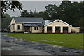
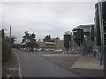
The Kirkland and Catterall Memorial Hall
Image: © Ian Greig
Taken: 21 Aug 2015
0.17 miles