
IMAGES TAKEN NEAR TO
Butt Hill Lane, PRESTON, PR3 0GN
Introduction
This page details the photographs taken nearby to Butt Hill Lane, PR3 0GN by members of the Geograph project.
The Geograph project started in 2005 with the aim of publishing, organising and preserving representative images for every square kilometre of Great Britain, Ireland and the Isle of Man.

There are currently over 7.5m images from over14,400 individuals and you can help contribute to the project by visiting https://www.geograph.org.uk
Image Map
Images are licensed for reuse under creativecommons.org/licenses/by-sa/2.0
Notes
- Clicking on the map will re-center to the selected point.
- The higher the marker number, the further away the image location is from the centre of the postcode.
Image Listing (11 Images Found)
Images are licensed for reuse under creativecommons.org/licenses/by-sa/2.0
Image
Details
Distance
1
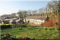
Farm by River Calder
Not named on maps, and no sign visible on the ground.
Image: © Bob Jenkins
Taken: 18 Mar 2009
0.08 miles
2
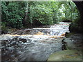
River Calder beneath Sandholme Bridge.
A view of the River Calder looking east, taken beneath beneath Sandholme Bridge. This innocuous looking road bridge gives no clue to the small ravine below when crossed from above.
It is nearly 200yrs old according to the date of 1811 carved in the side. The river is not always this full.
Image: © Lakeland Ramblers
Taken: 1 Jul 2007
0.17 miles
4
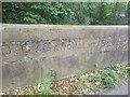
Old Bridge Marker on Sandholme Bridge, Barnacre with Bonds parish
Bridge Marker inscribed in the parapet of Sandholme Bridge, River Calder, on the east side of Sandholme Lane. Barnacre with Bonds parish. Grade II Listed details https://historicengland.org.uk/listing/the-list/list-entry/1072909. See also https://www.geograph.org.uk/photo/482909.
Milestone Society National ID: LA_BERN02br
Image: © D Phillips
Taken: 1 Sep 2023
0.19 miles
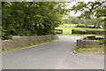
6
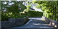
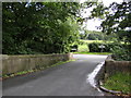
Sandholme Bridge
The bridge crosses the River Calder
Image: © Ian Greig
Taken: 5 Jun 2015
0.20 miles
7
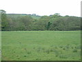
Farmland, looking towards Curwen Wood, near Garstang
Looking north
Image: © David Medcalf
Taken: 21 May 2005
0.20 miles
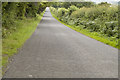
9
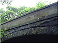
Sandholme Bridge near to Claughton.
A view of the date (1811) on the side of Sandholme Bridge. It's a shame that this date is not visible to normal road users.
It is curious that the part of the bridge with the date appears newer than the arch. Could it be that the bridge is even older?
Image: © Lakeland Ramblers
Taken: 1 Jul 2007
0.21 miles
10
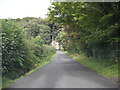
Bell Lane
The house in the distance is in next square.
Image: © Peter Bond
Taken: 17 Aug 2008
0.22 miles