IMAGES TAKEN NEAR TO
Higher Bank Road, PRESTON, PR2 8PH
Introduction
This page details the photographs taken nearby to Higher Bank Road, PR2 8PH by members of the Geograph project.
The Geograph project started in 2005 with the aim of publishing, organising and preserving representative images for every square kilometre of Great Britain, Ireland and the Isle of Man.

There are currently over 7.5m images from over14,400 individuals and you can help contribute to the project by visiting https://www.geograph.org.uk
Image Map
Images are licensed for reuse under creativecommons.org/licenses/by-sa/2.0
Notes
- Clicking on the map will re-center to the selected point.
- The higher the marker number, the further away the image location is from the centre of the postcode.
Image Listing (13 Images Found)
Images are licensed for reuse under creativecommons.org/licenses/by-sa/2.0
Image
Details
Distance
1
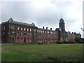
Former workhouse in Fulwood, Preston
This was built as Fulwood workhouse. It is now part of the University of Central Lancashire.
Image: © Andrew Gritt
Taken: 12 Sep 2007
0.13 miles
2
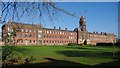
Former Workhouse in Fulwood
This spectacular building was originally a Victorian workhouse. It is now offices.
Image: © Peter
Taken: 18 Nov 2018
0.14 miles
4
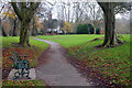
Moor Park
This path winds round the northern side of the park with North Lodge in the background. Moor Park was created when Preston Council enclosed 100 acres of Preston Moor making it the first municipal park in the new industrial towns of north-west England. Improvements were carried out between 1862 and 1865 by garden designer Edward Milner using the labour of unemployed cotton workers.
Image: © Stephen McKay
Taken: 30 Nov 2022
0.17 miles
5

The Serpentine, drained
In Moor Park, behind security fencing being renovated with removal of silt and plans to restore bridges across the lake.
Image: © Kevin Waterhouse
Taken: 29 May 2026
0.20 miles
6
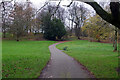
Moor Park
This view shows the path round the northern side of the park. Moor Park was created when Preston Council enclosed 100 acres of Preston Moor making it the first municipal park in the new industrial towns of north-west England. Improvements were carried out between 1862 and 1865 by garden designer Edward Milner using the labour of unemployed cotton workers.
Image: © Stephen McKay
Taken: 30 Nov 2022
0.20 miles
7
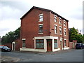
No57 Victoria Road, Fulwood
A former Post Office
Image: © Alexander P Kapp
Taken: 6 Aug 2008
0.20 miles