IMAGES TAKEN NEAR TO
Winter Hill Close, PRESTON, PR2 5BJ
Introduction
This page details the photographs taken nearby to Winter Hill Close, PR2 5BJ by members of the Geograph project.
The Geograph project started in 2005 with the aim of publishing, organising and preserving representative images for every square kilometre of Great Britain, Ireland and the Isle of Man.

There are currently over 7.5m images from over14,400 individuals and you can help contribute to the project by visiting https://www.geograph.org.uk
Image Map
Images are licensed for reuse under creativecommons.org/licenses/by-sa/2.0
Notes
- Clicking on the map will re-center to the selected point.
- The higher the marker number, the further away the image location is from the centre of the postcode.
Image Listing (14 Images Found)
Images are licensed for reuse under creativecommons.org/licenses/by-sa/2.0
Image
Details
Distance
1
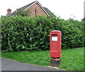
Elizabeth II postbox on The Hills, Grimsargh
Postbox No. PR2 301.
See Image] for context.
Image: © JThomas
Taken: 24 Sep 2016
0.07 miles
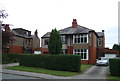
2
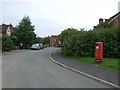
The Hills, Grimsargh
Showing position of Postbox No. PR2 301.
See Image] for postbox.
Image: © JThomas
Taken: 24 Sep 2016
0.07 miles
4
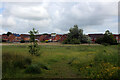
Approaching "The Hills" Housing Estate
Crossing a patch of rough ground between the housing estate and the disused Longridge/Preston railway line
Image: © Chris Heaton
Taken: 11 Jun 2022
0.09 miles
7
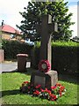
War Memorial
The memorial at Three Mile Cross, Grimsargh.
Image: © Roger May
Taken: 8 Aug 2005
0.11 miles
8
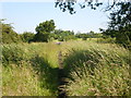
Footpath
With St Michael's Church in the distance
Image: © Alexander P Kapp
Taken: 24 Jun 2009
0.14 miles
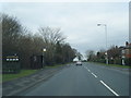
9
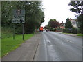
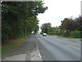
Entering Grimsargh Village
Heading north east on the B6243.
Image: © JThomas
Taken: 24 Sep 2016
0.15 miles
10
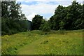
Patch of Rough Ground, Red Scar
Footpath approaching the former railway between Longridge and Preston, concealed by a line of trees
Image: © Chris Heaton
Taken: 11 Jun 2022
0.17 miles