IMAGES TAKEN NEAR TO
Snowdrop Close, LEYLAND, PR25 5TG
Introduction
This page details the photographs taken nearby to Snowdrop Close, PR25 5TG by members of the Geograph project.
The Geograph project started in 2005 with the aim of publishing, organising and preserving representative images for every square kilometre of Great Britain, Ireland and the Isle of Man.

There are currently over 7.5m images from over14,400 individuals and you can help contribute to the project by visiting https://www.geograph.org.uk
Image Map
Images are licensed for reuse under creativecommons.org/licenses/by-sa/2.0
Notes
- Clicking on the map will re-center to the selected point.
- The higher the marker number, the further away the image location is from the centre of the postcode.
Image Listing (41 Images Found)
Images are licensed for reuse under creativecommons.org/licenses/by-sa/2.0
Image
Details
Distance
1

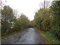
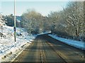
Approaching the 30 mile per hour speed limit
This is where Shady lane meets the B5256 and a 30 mile restriction is reached. It would be difficult and dangerous to have driven more than 30 mph along Shady lane! It's a narrow, single track lane.
Image: © Ann Cook
Taken: 21 Aug 2010
0.07 miles

4
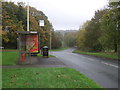
Bus stop and shelter on B5256, Clayton-le-Woods
Image: © JThomas
Taken: 25 Oct 2018
0.09 miles
5
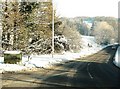
Town Brow, Clayton-le-Woods
The lane going right, at the top of the hill, is Shady lane.
Image: © Ann Cook
Taken: 2 Aug 2010
0.10 miles
9
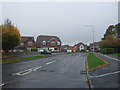
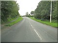
Magnolia Drive, Clayton-le-Woods
Looking north.
Image: © JThomas
Taken: 25 Oct 2018
0.13 miles