IMAGES TAKEN NEAR TO
Brook Close, LEYLAND, PR25 1UR
Introduction
This page details the photographs taken nearby to Brook Close, PR25 1UR by members of the Geograph project.
The Geograph project started in 2005 with the aim of publishing, organising and preserving representative images for every square kilometre of Great Britain, Ireland and the Isle of Man.

There are currently over 7.5m images from over14,400 individuals and you can help contribute to the project by visiting https://www.geograph.org.uk
Image Map
Images are licensed for reuse under creativecommons.org/licenses/by-sa/2.0
Notes
- Clicking on the map will re-center to the selected point.
- The higher the marker number, the further away the image location is from the centre of the postcode.
Image Listing (34 Images Found)
Images are licensed for reuse under creativecommons.org/licenses/by-sa/2.0
Image
Details
Distance
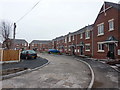
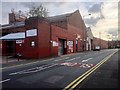
3
Dunkirk Lane at the junction with Leyland Lane
Image: © Ann Cook
Taken: 19 Mar 2011
0.04 miles
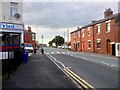
7
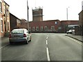
Dunkirk Lane at the junction with Mill Street
Mill Street is one-way and so traffic cannot turn into Mill Street at this point.
Image: © Ann Cook
Taken: 19 Mar 2011
0.10 miles
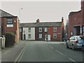
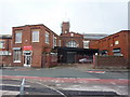
8
Baptist Church Leyland
Baptist Church Leyland Lane, founded in 1960 and still open when the image was taken.
Image: © Steve Houldsworth
Taken: 9 Jan 2011
0.11 miles
9
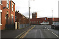
Crown of thorns
An old mill, now converted to factory units, becomes home to a forest of radio telephone masts
Image: © David Long
Taken: 17 Jan 2006
0.12 miles
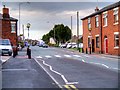
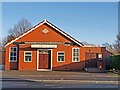
10
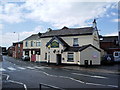
The " Old Original Seven Stars", Leyland
Image: © Alexander P Kapp
Taken: 15 Jul 2007
0.12 miles