IMAGES TAKEN NEAR TO
Whitby Avenue, PRESTON, PR2 3GB
Introduction
This page details the photographs taken nearby to Whitby Avenue, PR2 3GB by members of the Geograph project.
The Geograph project started in 2005 with the aim of publishing, organising and preserving representative images for every square kilometre of Great Britain, Ireland and the Isle of Man.

There are currently over 7.5m images from over14,400 individuals and you can help contribute to the project by visiting https://www.geograph.org.uk
Image Map
Images are licensed for reuse under creativecommons.org/licenses/by-sa/2.0
Notes
- Clicking on the map will re-center to the selected point.
- The higher the marker number, the further away the image location is from the centre of the postcode.
Image Listing (9 Images Found)
Images are licensed for reuse under creativecommons.org/licenses/by-sa/2.0
Image
Details
Distance
1
Tanterton Hall Road, Ingol
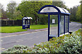
Two of Preston's neat bus shelters almost face each other on Tanterton Hall Road in the city's north-western suburbs.
Image: © Stephen McKay
Taken: 25 Apr 2023
0.05 miles
2
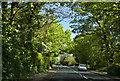
Tom Benson Way, Cottam
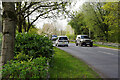
Named after Preston's famous marathon walker, this modern road, opened in 1985, is a stretch of the B6241 giving access to some of the city's north-western suburbs.
Image: © Stephen McKay
Taken: 25 Apr 2023
0.09 miles
3
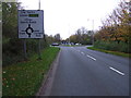
Tom Benson Way (B6241)
Heading south towards Preston City Centre.
Image: © JThomas
Taken: 1 Nov 2014
0.16 miles
4
The Ancient Oak, Cottam
This large modern pub on Merrytrees Lane is operated by Ember Inns, part of Mitchells & Butlers. It is very much a family-friendly food-orientated establishment.
Image: © Stephen McKay
Taken: 25 Apr 2023
0.17 miles
6
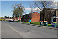
Whitby Avenue, Ingol
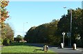
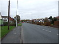
Preston began to expand into the Ingol area in the early 1960s and the housing stock here is of its time.
Image: © Stephen McKay
Taken: 25 Apr 2023
0.18 miles
7
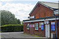
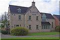
Ingol Social Club
It is something of a mystery as to why these sort of places invariably look so unprepossessing from the outside. Ingol Social Club on Whitby Avenue, with its stained brickwork, 1960s-style windows and fascia, solid doors, old bin, and weeds growing up from the bottom of the wall, is no exception. Apparently it has been refurbished to 'a very high standard' - it's a pity they didn't knock it down and start again. The club first opened as the Ingol Labour Club in 1968.
Image: © Stephen McKay
Taken: 25 Apr 2023
0.20 miles