IMAGES TAKEN NEAR TO
Houldsworth Road, PRESTON, PR2 3DQ
Introduction
This page details the photographs taken nearby to Houldsworth Road, PR2 3DQ by members of the Geograph project.
The Geograph project started in 2005 with the aim of publishing, organising and preserving representative images for every square kilometre of Great Britain, Ireland and the Isle of Man.

There are currently over 7.5m images from over14,400 individuals and you can help contribute to the project by visiting https://www.geograph.org.uk
Image Map
Images are licensed for reuse under creativecommons.org/licenses/by-sa/2.0
Notes
- Clicking on the map will re-center to the selected point.
- The higher the marker number, the further away the image location is from the centre of the postcode.
Image Listing (20 Images Found)
Images are licensed for reuse under creativecommons.org/licenses/by-sa/2.0
Image
Details
Distance
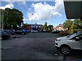
4
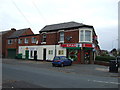
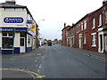
Convenience store
Spar Shop on Lytham Road.
Image: © JThomas
Taken: 16 Nov 2013
0.12 miles
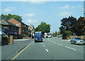
6
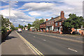
Traffic on the A6, Garstang Road, seen from a petrol station
Image: © Rob Purvis
Taken: 8 Aug 2016
0.16 miles
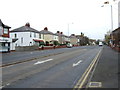
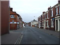
7
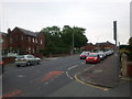
Plungington Road at the corner of Talbot Street
Image: © Rob Purvis
Taken: 27 Jun 2011
0.16 miles