IMAGES TAKEN NEAR TO
Tees Street, PRESTON, PR1 6XR
Introduction
This page details the photographs taken nearby to Tees Street, PR1 6XR by members of the Geograph project.
The Geograph project started in 2005 with the aim of publishing, organising and preserving representative images for every square kilometre of Great Britain, Ireland and the Isle of Man.

There are currently over 7.5m images from over14,400 individuals and you can help contribute to the project by visiting https://www.geograph.org.uk
Image Map
Images are licensed for reuse under creativecommons.org/licenses/by-sa/2.0
Notes
- Clicking on the map will re-center to the selected point.
- The higher the marker number, the further away the image location is from the centre of the postcode.
Image Listing (10 Images Found)
Images are licensed for reuse under creativecommons.org/licenses/by-sa/2.0
Image
Details
Distance
1
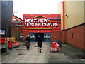
West View Leisure Centre
West View sports a very good climbing wall
Image: © Keith Wright
Taken: 14 Mar 2006
0.10 miles
2
The New Deepdale, St Georges Road, Preston
Image: © Alexander P Kapp
Taken: 6 Aug 2008
0.13 miles
3
New medical centre on St Gregory Road, Preston
Image: © Alexander P Kapp
Taken: 6 Aug 2008
0.15 miles
5
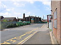
Deepdale Mill Street level crossing
Mid-19th-century changes to the railway layout in northern Preston left the original terminus of the Preston & Longridge Railway on a short branch, where it survived as a coal yard until the 1990s. Although the line has since been disused, the rails still remain in situ for most of the way and are seen here crossing Deepdale Mill Street on the level. The later extension to Maudlands passed under this road just to the right of the picture and ran between the mosque and the terraced housing in the background.
Image: © A-M-Jervis
Taken: 9 Aug 2007
0.18 miles
6
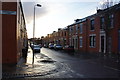
Castleton Road, Preston
Traditional residential street in the Deepdale area. It is experiencing sun after showers.
Image: © Bill Boaden
Taken: 18 Feb 2012
0.20 miles
7
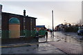
Mosque on the corner of Peel Hall Street
In the distance along Deepdale Mill Street on the right, you can see Preston North End's football stadium. The ground is wet from a recent very sharp hail shower.
Image: © Bill Boaden
Taken: 18 Feb 2012
0.21 miles
8
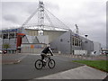
Preston North End stadium
The club started as a cricket club (playing across the road in Moor Park), later switched to rugby and finally to soccer. It now hosts the National Football Museum. (Part of a circular walk around Preston – continues at Image)
Image: © Patrick
Taken: 9 Sep 2007
0.23 miles
9
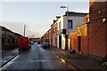
Andrew Street
Side street off Ribbleton Lane with distant views of Preston North End's ground at Deepdale.
Image: © Bill Boaden
Taken: 18 Feb 2012
0.24 miles