
IMAGES TAKEN NEAR TO
Wren Street, PRESTON, PR1 6TB
Introduction
This page details the photographs taken nearby to Wren Street, PR1 6TB by members of the Geograph project.
The Geograph project started in 2005 with the aim of publishing, organising and preserving representative images for every square kilometre of Great Britain, Ireland and the Isle of Man.

There are currently over 7.5m images from over14,400 individuals and you can help contribute to the project by visiting https://www.geograph.org.uk
Image Map
Images are licensed for reuse under creativecommons.org/licenses/by-sa/2.0
Notes
- Clicking on the map will re-center to the selected point.
- The higher the marker number, the further away the image location is from the centre of the postcode.
Image Listing (24 Images Found)
Images are licensed for reuse under creativecommons.org/licenses/by-sa/2.0
Image
Details
Distance
1
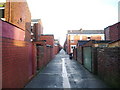
Back street
This back street runs parallel Holmrook Road
Image: © Alexander P Kapp
Taken: 16 Jan 2008
0.01 miles
4
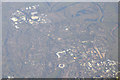
Preston : Preston Aerial Scenery
Looking down to the town of Preston from a flight which had departed from London Heathrow.
Image: © Lewis Clarke
Taken: 5 Jan 2017
0.05 miles
5
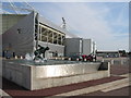
Preston North End Football Ground, Deepdale
With "The Splash" in the foreground (by Peter Hodgkinson) based on a photograph of Tom Finney at Stamford Bridge in 1956
Image: © Dave Brown
Taken: 9 Jul 2005
0.05 miles
6
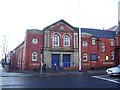
Guttridge Methodist Church, Deepdale Road, Preston
Image: © Alexander P Kapp
Taken: 16 Jan 2008
0.07 miles
7
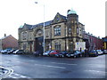
Offices of the old Preston Corporation Bus Depot
Still used for the buses for Preston
Image: © Alexander P Kapp
Taken: 16 Jan 2008
0.09 miles
8
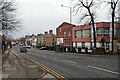
Deepdale Road, Preston
Looking towards the city centre from outside Deepdale Stadium. On the right is Moor Park High School.
Image: © Stephen McKay
Taken: 30 Nov 2022
0.14 miles
9
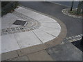
Boundary markers in Deepdale Road
The Preston and Longridge railway eventually became jointly owned by the London & North Western and Lancashire & Yorkshire Railway Companies. The line passed under Deepdale Road near the junction with Barrow Road but the railway company owned a small piece of land at the road junction behind their bridge parapet and the outer row of stones, suitably initialled, were laid to define their property boundary. The four grey panels in the inner vee, inscribed with fish, flowers and castle sketches, are a recent addition as part of a community project to improve the appearance of the area.
Image: © A-M-Jervis
Taken: 9 Aug 2007
0.14 miles
10
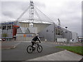
Preston North End stadium
The club started as a cricket club (playing across the road in Moor Park), later switched to rugby and finally to soccer. It now hosts the National Football Museum. (Part of a circular walk around Preston – continues at Image)
Image: © Patrick
Taken: 9 Sep 2007
0.15 miles