
IMAGES TAKEN NEAR TO
Church Row, PRESTON, PR1 3BX
Introduction
This page details the photographs taken nearby to Church Row, PR1 3BX by members of the Geograph project.
The Geograph project started in 2005 with the aim of publishing, organising and preserving representative images for every square kilometre of Great Britain, Ireland and the Isle of Man.

There are currently over 7.5m images from over14,400 individuals and you can help contribute to the project by visiting https://www.geograph.org.uk
Image Map
Images are licensed for reuse under creativecommons.org/licenses/by-sa/2.0
Notes
- Clicking on the map will re-center to the selected point.
- The higher the marker number, the further away the image location is from the centre of the postcode.
Image Listing (324 Images Found)
Images are licensed for reuse under creativecommons.org/licenses/by-sa/2.0
Image
Details
Distance
1
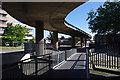
Preston Bus Station
One of the access ramps to the multi-storey car park.
Pedestrian access to the bus station is provided by subway and bridge. I assume that people tend to avoid these. There is now a proliferation of railings, both permanent and temporary.
Image: © Ian Taylor
Taken: 26 Aug 2012
0.01 miles
2
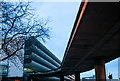
Car Park entry ramp, Preston Bus Station
Currently undergoing massive redevelopment...http://www.lancashire.gov.uk/council/strategies-policies-plans/roads-parking-and-travel/revitalising-preston-bus-station.aspx
Image: © Matt Harrop
Taken: 8 Feb 2017
0.01 miles
3

Lord's Walk ramp from the top level of Preston bus station car park
Image: © shikari
Taken: 20 Jul 2025
0.02 miles
4
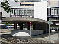
Taxi rank, Tithebarn Street, Preston
Part of the bus station (Image]). More thought has gone into this than most taxi ranks.
Image: © Stephen Richards
Taken: 11 Jun 2013
0.02 miles
5

Guild Centre, Tithebarn Street, Preston
One of a number of large post-war developments surrounding the bus station like satellites. This typically forceful Brutalist effort was the last element of the Guild Hall complex and was built in 1976 to the design of Building Design Partnership. Pink concrete which has acquired a brown tinge over the years (or maybe it was just the light). The city's tallest building (c200 feet).
Redevelopment of the whole complex beckons.
Image: © Stephen Richards
Taken: 11 Jun 2013
0.03 miles
6
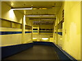
Subway to Preston bus station
This subway provides pedestrian access from the Guildhall shopping centre (behind the photographer) to the bus station. (See Image for where it ends up.)
Image: © Richard Vince
Taken: 18 Aug 2012
0.03 miles
7
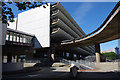
Preston Bus Station
Showing one of the access ramps to the multi-storey car park, and the enclosed footbridge.
Image: © Ian Taylor
Taken: 26 Aug 2012
0.03 miles
8
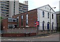
Carey Baptist Church - Pole Street
Image: © Betty Longbottom
Taken: 12 Aug 2007
0.03 miles
9
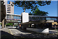
Preston Bus Station
This is the pick-up, drop-off and taxi waiting area. Pedestrian access to the bus station is provided by a subway.
Image: © Ian Taylor
Taken: 26 Aug 2012
0.04 miles
10

Ramp to nowhere at one end of the top floor of Preston bus station car park
Image: © shikari
Taken: 20 Jul 2025
0.04 miles