IMAGES TAKEN NEAR TO
Essex Street, PRESTON, PR1 1QE
Introduction
This page details the photographs taken nearby to Essex Street, PR1 1QE by members of the Geograph project.
The Geograph project started in 2005 with the aim of publishing, organising and preserving representative images for every square kilometre of Great Britain, Ireland and the Isle of Man.

There are currently over 7.5m images from over14,400 individuals and you can help contribute to the project by visiting https://www.geograph.org.uk
Image Map
Images are licensed for reuse under creativecommons.org/licenses/by-sa/2.0
Notes
- Clicking on the map will re-center to the selected point.
- The higher the marker number, the further away the image location is from the centre of the postcode.
Image Listing (26 Images Found)
Images are licensed for reuse under creativecommons.org/licenses/by-sa/2.0
Image
Details
Distance
1
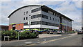
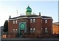
Recycling Lives
The building that houses the Recycling Lives Charity and also part of Preston College.
Image: © K A
Taken: 25 Jun 2012
0.05 miles
2
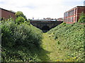
Deepdale No 3 Tunnel, Preston
The Preston & Longridge Railway was opened in 1840, the primary purpose for its promotion being to carry stone from Longridge Fell for use in public buildings in Preston and the docks at Liverpool. From its terminus on the banks of the Lancaster Canal at Maudlands it ran through a series of closely-spaced tunnels totalling half a mile in length under Deepdale. This is the easternmost portal of the tunnels, taken from St Pauls Road bridge. The line, which latterly served a coal yard at Deepdale, has been disused for a number of years but there is still a single line of rails beneath the grass. Just visible in the far background above the tunnel is the spire of St Walburge's Church, possibly the tallest church spire in Preston.
Image: © A-M-Jervis
Taken: 9 Aug 2007
0.06 miles
3
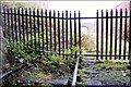
Deepdale number three East portal
For many more pictures, history and information on the Preston deepdale tunnels see here http://www.flickr.com/photos/phill_dvsn/sets/72157610400076493/detail/
Image: © philld
Taken: 29 Nov 2008
0.06 miles
4
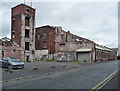
Former Hanover Street Mill, Kent Street, Preston
Former cotton mill, dated c1825. Despite this, and its listing, partly demolished at the time, the remainder standing idle. Grade II listed.
Image: © Stephen Richards
Taken: 12 Jun 2013
0.08 miles
5

Overgrown and disused railway
The former railway to Longridge that was retained as a short freight branch line within Preston for many years. Seen from the bridge on St Paul's Road.
Image: © Kevin Waterhouse
Taken: 29 May 2026
0.08 miles