IMAGES TAKEN NEAR TO
High Lawn Way, HAVANT, PO9 5BU
Introduction
This page details the photographs taken nearby to High Lawn Way, PO9 5BU by members of the Geograph project.
The Geograph project started in 2005 with the aim of publishing, organising and preserving representative images for every square kilometre of Great Britain, Ireland and the Isle of Man.

There are currently over 7.5m images from over14,400 individuals and you can help contribute to the project by visiting https://www.geograph.org.uk
Image Map
Images are licensed for reuse under creativecommons.org/licenses/by-sa/2.0
Notes
- Clicking on the map will re-center to the selected point.
- The higher the marker number, the further away the image location is from the centre of the postcode.
Image Listing (89 Images Found)
Images are licensed for reuse under creativecommons.org/licenses/by-sa/2.0
Image
Details
Distance
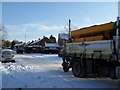
1
Electricity sub-station in High Lawn Way
Image: © Basher Eyre
Taken: 9 Jan 2010
0.02 miles
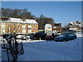
3
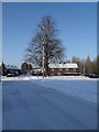
Looking towards a splendid tree in High Lawn Way
Image: © Basher Eyre
Taken: 9 Jan 2010
0.03 miles
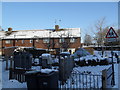
5
Passing Front Lawn schools in High Lawn Way
Image: © Basher Eyre
Taken: 9 Jan 2010
0.04 miles
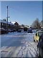
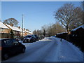
6
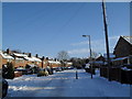
Approaching the junction of a snowy High Lawn Way and Broadmere Avenue
Image: © Basher Eyre
Taken: 9 Jan 2010
0.04 miles
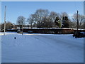
8
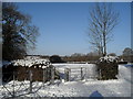
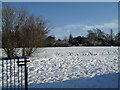
Looking from High Lawn Way across fields to Middle Park Way
Image: © Basher Eyre
Taken: 9 Jan 2010
0.04 miles