IMAGES TAKEN NEAR TO
Holybourne Road, HAVANT, PO9 2BN
Introduction
This page details the photographs taken nearby to Holybourne Road, PO9 2BN by members of the Geograph project.
The Geograph project started in 2005 with the aim of publishing, organising and preserving representative images for every square kilometre of Great Britain, Ireland and the Isle of Man.

There are currently over 7.5m images from over14,400 individuals and you can help contribute to the project by visiting https://www.geograph.org.uk
Image Map
Images are licensed for reuse under creativecommons.org/licenses/by-sa/2.0
Notes
- Clicking on the map will re-center to the selected point.
- The higher the marker number, the further away the image location is from the centre of the postcode.
Image Listing (228 Images Found)
Images are licensed for reuse under creativecommons.org/licenses/by-sa/2.0
Image
Details
Distance
1
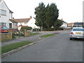
Junction of Holybourne Road and Chilcombe Close
Image: © Basher Eyre
Taken: 24 Mar 2009
0.02 miles
2
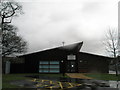
Trospacc Nursery
Situated right next to Trosnant Infant and Trosnant Junior Schools.
Image: © Basher Eyre
Taken: 9 Dec 2007
0.05 miles
3
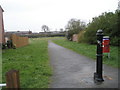
Entrance to wasteground behind Blendworth Crescent
Image: © Basher Eyre
Taken: 24 Mar 2008
0.07 miles
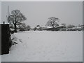
4
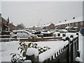
Looking across a snowy garden towards Blendworth Crescent
Image: © Basher Eyre
Taken: 6 Jan 2010
0.08 miles
6
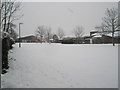
Trosnant schools playground in the snow (2)
Image: © Basher Eyre
Taken: 6 Jan 2010
0.09 miles
7
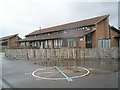
Rear of Trosnant Infant School
Taken on a soakingly wet December lunchtime.
Image: © Basher Eyre
Taken: 9 Dec 2007
0.09 miles
9
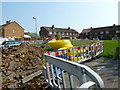
Rubble and pipes in Blendworth Crescent
Image: © Basher Eyre
Taken: 17 Apr 2011
0.09 miles
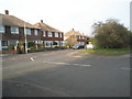
10
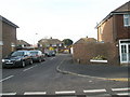
Junction of Fitzwygram Crescent and The Drive
Image: © Basher Eyre
Taken: 24 Mar 2009
0.10 miles