IMAGES TAKEN NEAR TO
Longcroft Way, HAVANT, PO9 1FL
Introduction
This page details the photographs taken nearby to Longcroft Way, PO9 1FL by members of the Geograph project.
The Geograph project started in 2005 with the aim of publishing, organising and preserving representative images for every square kilometre of Great Britain, Ireland and the Isle of Man.

There are currently over 7.5m images from over14,400 individuals and you can help contribute to the project by visiting https://www.geograph.org.uk
Image Map
Images are licensed for reuse under creativecommons.org/licenses/by-sa/2.0
Notes
- Clicking on the map will re-center to the selected point.
- The higher the marker number, the further away the image location is from the centre of the postcode.
Image Listing (352 Images Found)
Images are licensed for reuse under creativecommons.org/licenses/by-sa/2.0
Image
Details
Distance
1
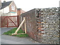
A modern day buttress
A novel solution to a leaning wall.
Image: © Basher Eyre
Taken: 24 Nov 2007
0.03 miles
2
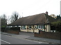
Former Farm Cottages in Brockhampton Lane
Now converted to private homes now the farm is no more.
Image: © Basher Eyre
Taken: 24 Nov 2007
0.03 miles
3
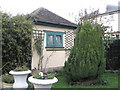
Shed in Brockhampton Lane
A shed to die for all my friends agreed.
Image: © Basher Eyre
Taken: 24 Nov 2007
0.03 miles
4

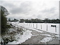
Looking across farmland adjoining Portsmouth Water Company to Apollo Fire Alarms
Image: © Basher Eyre
Taken: 6 Apr 2008
0.05 miles
5
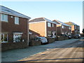
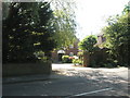
A frosty scene outside the new houses in Ranelagh Road
Image: © Basher Eyre
Taken: 7 Dec 2008
0.06 miles
7
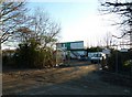
Site office for the new build in Ranelagh Road
Image: © Basher Eyre
Taken: 28 Jan 2011
0.06 miles