IMAGES TAKEN NEAR TO
Hambledon Road, WATERLOOVILLE, PO7 6PN
Introduction
This page details the photographs taken nearby to Hambledon Road, PO7 6PN by members of the Geograph project.
The Geograph project started in 2005 with the aim of publishing, organising and preserving representative images for every square kilometre of Great Britain, Ireland and the Isle of Man.

There are currently over 7.5m images from over14,400 individuals and you can help contribute to the project by visiting https://www.geograph.org.uk
Image Map
Images are licensed for reuse under creativecommons.org/licenses/by-sa/2.0
Notes
- Clicking on the map will re-center to the selected point.
- The higher the marker number, the further away the image location is from the centre of the postcode.
Image Listing (14 Images Found)
Images are licensed for reuse under creativecommons.org/licenses/by-sa/2.0
Image
Details
Distance
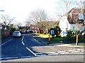
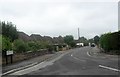
2
Looking north from the junction of The Heath and the B2150
Image: © Shazz
Taken: 19 Dec 2014
0.08 miles
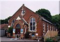
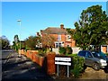
4
Denmead War Memorial Hall
The white plaque over the green door records: 'Erected in memory of those who fell and those who served in the Great War 1914-1918'.
Image: © Chris Henley
Taken: 30 Sep 2006
0.11 miles

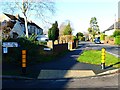
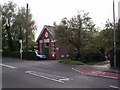
7
Looking along Hambledon Road from The Shrubbery
Image: © Shazz
Taken: 19 Dec 2014
0.14 miles
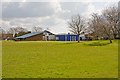
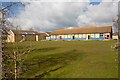
9
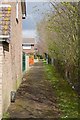
Path along the back of housing in Fieldway, Denmead
Image: © Peter Facey
Taken: 27 Mar 2008
0.15 miles