IMAGES TAKEN NEAR TO
Falmouth Road, PORTSMOUTH, PO6 4JT

Introduction

This page details the photographs taken nearby to Falmouth Road, PO6 4JT by members of the Geograph project.

The Geograph project started in 2005 with the aim of publishing, organising and preserving representative images for every square kilometre of Great Britain, Ireland and the Isle of Man.

There are currently over 7.5m images from over14,400 individuals and you can help contribute to the project by visiting https://www.geograph.org.uk

Image Map


Images are licensed for reuse under creativecommons.org/licenses/by-sa/2.0
Notes
  • Clicking on the map will re-center to the selected point.
  • The higher the marker number, the further away the image location is from the centre of the postcode.

Image Listing (71 Images Found)

Images are licensed for reuse under creativecommons.org/licenses/by-sa/2.0
  • ...
Image
Details
Distance
1
Junction of Bude Close and Falmouth Road
Image: © Basher Eyre Taken: 20 Dec 2008
0.06 miles
2
Historic houses
Taken in Bude Close, these pre-fabs as a genre are being considered for listed building status because they have lasted way, way beyond their original time limit because many people love living here so much.
Image: © Basher Eyre Taken: 20 Dec 2008
0.06 miles
3
Looking westwards along Falmouth Road
Image: © Basher Eyre Taken: 20 Dec 2008
0.07 miles
4
Car parking spaces in Bude Close
Image: © Basher Eyre Taken: 20 Dec 2008
0.09 miles
5
Looking westwards along Newbolt Road
Image: © Basher Eyre Taken: 20 Dec 2008
0.10 miles
6
View from footbridge down into Falmouth Road
Image: © Basher Eyre Taken: 20 Dec 2008
0.11 miles
7
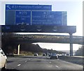
M27, eastbound
Image: © N Chadwick Taken: 27 Sep 2014
0.11 miles
8
Track behind Hillsley Road
Image: © Basher Eyre Taken: 20 Dec 2008
0.11 miles
9
Half mile to Junction 12, M27
Image: © N Chadwick Taken: 2 Jan 2012
0.11 miles
10
Bus shelter in Hillsley Road
Image: © Basher Eyre Taken: 20 Dec 2008
0.11 miles
  • ...