IMAGES TAKEN NEAR TO
Abbeydore Road, PORTSMOUTH, PO6 4AJ
Introduction
This page details the photographs taken nearby to Abbeydore Road, PO6 4AJ by members of the Geograph project.
The Geograph project started in 2005 with the aim of publishing, organising and preserving representative images for every square kilometre of Great Britain, Ireland and the Isle of Man.

There are currently over 7.5m images from over14,400 individuals and you can help contribute to the project by visiting https://www.geograph.org.uk
Image Map
Images are licensed for reuse under creativecommons.org/licenses/by-sa/2.0
Notes
- Clicking on the map will re-center to the selected point.
- The higher the marker number, the further away the image location is from the centre of the postcode.
Image Listing (337 Images Found)
Images are licensed for reuse under creativecommons.org/licenses/by-sa/2.0
Image
Details
Distance
1
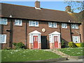
The "Artillery Houses" in Allaway Avenue
Image: © Basher Eyre
Taken: 23 Apr 2008
0.02 miles
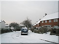
3
Alleyway from Allaway Avenue to Abbeydore Road
My stepson has just pointed out this is a somewhat alliterative caption.
Image: © Basher Eyre
Taken: 23 Apr 2008
0.03 miles
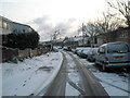
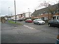
5
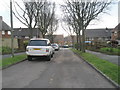
Looking southwards down Kingsland Close
Image: © Basher Eyre
Taken: 11 Dec 2009
0.03 miles
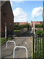
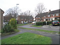
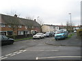
8
Junction of Kingsland Close and Abbeydore Road
Image: © Basher Eyre
Taken: 11 Dec 2009
0.04 miles
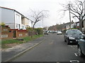
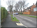
9
Looking from Kingsland Close into Abbeydore Road
Image: © Basher Eyre
Taken: 11 Dec 2009
0.04 miles