IMAGES TAKEN NEAR TO
Hamstead Drive, YARMOUTH, PO41 0YD
Introduction
This page details the photographs taken nearby to Hamstead Drive, PO41 0YD by members of the Geograph project.
The Geograph project started in 2005 with the aim of publishing, organising and preserving representative images for every square kilometre of Great Britain, Ireland and the Isle of Man.

There are currently over 7.5m images from over14,400 individuals and you can help contribute to the project by visiting https://www.geograph.org.uk
Image Map
Images are licensed for reuse under creativecommons.org/licenses/by-sa/2.0
Notes
- Clicking on the map will re-center to the selected point.
- The higher the marker number, the further away the image location is from the centre of the postcode.
Image Listing (8 Images Found)
Images are licensed for reuse under creativecommons.org/licenses/by-sa/2.0
Image
Details
Distance
1
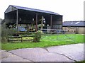
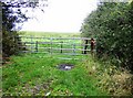
Forest View barn
Part of a farm on the edge of the woods, identified as a piggery on the 1:25K map.
Image: © Graham Horn
Taken: 28 Oct 2007
0.02 miles
2
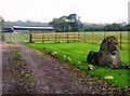
Lion in the grass...
...and protecting the entrance to this farm, which is not named on the map and I forgot to record its name from the gate. Perhaps I was frightened away by the lion?
Image: © Graham Horn
Taken: 28 Oct 2007
0.06 miles
3
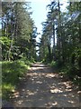
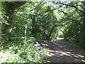
Hamstead Trail and coastal footpath in the direction of Lower Hamstead
The track is used by members of a boating club, found on the inlet about a mile along this lane.
Image: © David Smith
Taken: 20 Jun 2012
0.10 miles
4
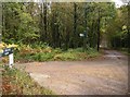
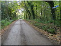
Coastal path junction
Much of the south-west part of the square consists of mixed woodland, with two significant tracks going through it. They meet here, the north-south one on the right of the picture and the Coastal Path and Hamstead Trail coming in from the left. They are all footpaths only as the roads themselves are private.
Image: © Graham Horn
Taken: 28 Oct 2007
0.11 miles
5
Farmland near Hamstead
A rather ordinary section of farmland with an arable crop dominates the northern part of this square.
Image: © Graham Horn
Taken: 28 Oct 2007
0.20 miles
6
Pigeon Coo; junction of tracks
Here is a meeting of the Hamstead Trail and IOW coastal path in a wooded landscape.
Image: © David Smith
Taken: 20 Jun 2012
0.22 miles
7
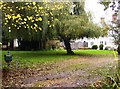
Pigeon Coo Farmhouse
I just like the name, and so do the mapmakers evidently as it is prominently named on both scales of map.
Image: © Graham Horn
Taken: 28 Oct 2007
0.22 miles
8
Coastal Footpath S27
Coastal Footpath S27 with Hamstead Trail cutting off to Pigeon Coo Farm
Image: © Shaun Ferguson
Taken: 30 Oct 2008
0.24 miles