IMAGES TAKEN NEAR TO
Puckwell Lane, VENTNOR, PO38 2AY
Introduction
This page details the photographs taken nearby to Puckwell Lane, PO38 2AY by members of the Geograph project.
The Geograph project started in 2005 with the aim of publishing, organising and preserving representative images for every square kilometre of Great Britain, Ireland and the Isle of Man.

There are currently over 7.5m images from over14,400 individuals and you can help contribute to the project by visiting https://www.geograph.org.uk
Image Map
Images are licensed for reuse under creativecommons.org/licenses/by-sa/2.0
Notes
- Clicking on the map will re-center to the selected point.
- The higher the marker number, the further away the image location is from the centre of the postcode.
Image Listing (96 Images Found)
Images are licensed for reuse under creativecommons.org/licenses/by-sa/2.0
Image
Details
Distance
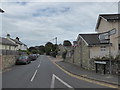
1
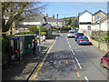
Niton, Rectory Road, at Niton, Rectory Road bus stop
Viewed from a route 6 bus heading for Newport the slow way.
Image: © Robin Webster
Taken: 14 Apr 2017
0.06 miles
2
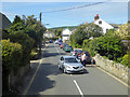
Rectory Road, Niton
Viewed from a route 6 bus heading for Newport the slow way.
Image: © Robin Webster
Taken: 14 Apr 2017
0.06 miles
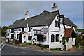
3
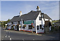
White Lion Pub, Niton, Isle of Wight
Great local Pub serving good food.
Image: © Rodney Harris
Taken: 19 Aug 2009
0.06 miles
6
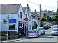
Niton Newsagents and Post Office
High Street, Niton
The road from Chale to Niton was built as a diversionary inland route following the collapse of the previous coastal road between Niton and Blackgang in 1928. It is of similar construction and is mostly from the same time period as the stretch to the west of Chale (The Isle of Wight Military Road http://www.geograph.org.uk/snippet/10058 ) which was re-built and upgraded at this time but this length of road is not usually covered by the term 'Military Road' and its name on street maps and signs is different.
Image: © David Dixon
Taken: 16 Jul 2013
0.06 miles
9
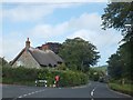
Thatched buildings at junction of Laceys Lane with Rectory Road in Niton
Image: © David Smith
Taken: 22 Jun 2012
0.07 miles
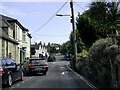
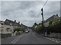
10
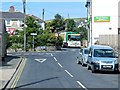
Niton, Rectory Road/High Street/Church Street Junction
Image: © David Dixon
Taken: 16 Jul 2013
0.08 miles