IMAGES TAKEN NEAR TO
Lincoln Way, BEMBRIDGE, PO35 5QJ
Introduction
This page details the photographs taken nearby to Lincoln Way, PO35 5QJ by members of the Geograph project.
The Geograph project started in 2005 with the aim of publishing, organising and preserving representative images for every square kilometre of Great Britain, Ireland and the Isle of Man.

There are currently over 7.5m images from over14,400 individuals and you can help contribute to the project by visiting https://www.geograph.org.uk
Image Map
Images are licensed for reuse under creativecommons.org/licenses/by-sa/2.0
Notes
- Clicking on the map will re-center to the selected point.
- The higher the marker number, the further away the image location is from the centre of the postcode.
Image Listing (49 Images Found)
Images are licensed for reuse under creativecommons.org/licenses/by-sa/2.0
Image
Details
Distance
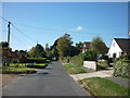
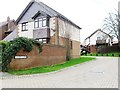
2
Bembridge : Howgate Road
Howgate Road in Bembridge with houses on either side.
Image: © Lewis Clarke
Taken: 30 Mar 2012
0.08 miles
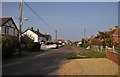
3
Bembridge : Howgate Road
Looking along Howgate Road.
Image: © Lewis Clarke
Taken: 15 Oct 2020
0.08 miles
4
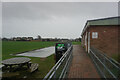
Turf Zone "BembridgePark"
At Steyne Park, Bembridge, Isle of Wight.
Image: © Ian S
Taken: 31 Dec 2022
0.12 miles
6
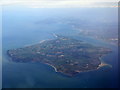
The Isle of Wight from the east
Seen from over the English Channel about 5km south of Bognor Regis. The nearest point is Foreland, Bembridge is just to the right and Culver Cliff and Sandown Bay are to the left.
Image: © M J Richardson
Taken: 4 May 2016
0.14 miles
7
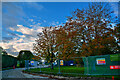
Bembridge : Howgate Road
Construction on Howgate Road.
Image: © Lewis Clarke
Taken: 15 Oct 2020
0.15 miles
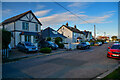
8
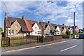
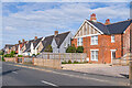
35 - 49 Steyne Road
Houses in Steyne Road, first marked on the 1946 25 inch map.
Image: © Ian Capper
Taken: 12 May 2022
0.18 miles
9
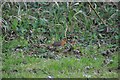
Bembridge : Robin on Howgate Road
A robin on Howgate Road in Bembridge.
Image: © Lewis Clarke
Taken: 30 Mar 2012
0.18 miles
10
35 - 49 Steyne Road
Houses in Steyne Road, first marked on the 1946 25 inch map.
Image: © Ian Capper
Taken: 12 May 2022
0.18 miles