1
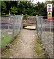
Lineside path towards Ryde
Alongside the Island Line north of this http://www.geograph.org.uk/photo/4696872 level crossing.
Image: © Jaggery
Taken: 10 Oct 2015
0.10 miles
2
Kissing gate to a level crossing near Swanmore
The gate gives access to this http://www.geograph.org.uk/photo/4696872 Island Line level crossing.
Image: © Jaggery
Taken: 10 Oct 2015
0.10 miles
3
Stop Look Listen notice near Swanmore
Facing Public Footpath R103 on the approach to an Island Line level crossing.
The yellow notice shows Danger - do not touch the live rail.
The red notice below it shows Warning - do not trespass on the railway. Penalty £1000.
Image: © Jaggery
Taken: 10 Oct 2015
0.11 miles
4
Kissing gate access to an Island Line level crossing near Swanmore
Ahead, Public Footpath R103 from Smallbrook to Ryde crosses the Island Line railway http://www.geograph.org.uk/photo/4696872
between Ryde St John's Road station and Smallbrook Junction station.
Image: © Jaggery
Taken: 10 Oct 2015
0.11 miles
5
Ryde suburbs, Class 483 at foot crossing
This crossing is roughly opposite Rosemary Vineyard, and connects with a footpath to either Pennyfeathers Bridge, near Smallbrook Stadium, or the St Johns/Elmfield area of Ryde. Unit No. 004 passes on a Shanklin train. Note the remains of an earlier era sign by the track.
Image: © Sam
Taken: 5 Sep 2016
0.11 miles
6
Lineside path towards Smallbrook
Alongside the Island Line south of this http://www.geograph.org.uk/photo/4696872 level crossing.
Image: © Jaggery
Taken: 10 Oct 2015
0.11 miles
7
Island Line level crossing near Swanmore
Public Footpath R103 from Smallbrook to Ryde crosses the Island Line railway between Ryde St John's Road station and Smallbrook Junction station.
Image: © Jaggery
Taken: 10 Oct 2015
0.11 miles
8
Footbridge over Monktonmead Brook, Ryde
Part of Public Footpath R103 from Ryde to Smallbrook.
Image: © Jaggery
Taken: 10 Oct 2015
0.12 miles
9
Island Line towards Ryde St John's Road station
North from this http://www.geograph.org.uk/photo/4696872 level crossing. This route has been electrified since 1967. The electric trains on this route take power from the third rail, two of which here end near the wooden slats at the edge of the level crossing.
Image: © Jaggery
Taken: 10 Oct 2015
0.12 miles
10
Pig Leg railway foot crossing
This is known to the railway as Pig Lane Crossing and provides a well-used footpath connection between the Ryde suburbs of Oakfield and Swanmore.
Image: © Andrew Culley
Taken: 19 Apr 2020
0.13 miles


