1
Upton Road, Haylands, Isle of Wight
Seen during a thunder storm, with torrential rain turning to hail. Looking up Upton Road, from the junction with Colenutt's Road.
With sodden trousers clinging to my legs, and doing my best John Wayne impression, I trudged up the hill. At the top of the hill, and with hail accumulating on the road and pavement, I found an elderly lady, and a motorcyclist (in leathers), sheltering where there was no shelter. I trudged on ...
Image: © Peter Trimming
Taken: 12 Apr 2012
0.06 miles
2
Lake Huron public house
Image: © Ian S
Taken: 16 Oct 2011
0.10 miles
3
Lake Huron Pub, Haylands
On the junction of Upton Road and Bettesworth Road in the Haylands district of Ryde. The name comes from the Lake family a 19th century family of brewers who owned a couple of pubs and named them after the great lakes, the Lake Huron survives but the Lake Superior in Elmfield has gone. A locals pub rather than one for tourists.
Image: © Simon Carey
Taken: 19 Aug 2007
0.12 miles
4
Pound Mead, Ryde
Image: © David Martin
Taken: 19 Aug 2012
0.12 miles
5
Upton Road, Haylands
On the outskirts of Ryde heading into town.
Image: © Simon Carey
Taken: 19 Aug 2007
0.14 miles
6
Upton Road, Haylands, Isle of Wight
Looking towards Ryde, as torrential rain fell, during a thunder storm. The thunder set off several car alarms.
Image: © Peter Trimming
Taken: 12 Apr 2012
0.15 miles
7
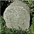
Old Boundary Marker on Playstreet Lane, Ryde
Municipal Boundary Marker next to a telecomms pole on the north side of the junction of Playstreet Lane and Corbett Road. Ryde parish. Inscribed R B and on the former boundary of Ryde Borough.
Milestone Society National ID: IW_RYDE04pb
Image: © P McCrickard
Taken: 1 May 2024
0.19 miles
8
One of Those April Showers!
Upton Road, on the outskirts of Ryde, looking towards the south-west. The thunder storm had converted to a hail storm. By this time, the worst was over.
Image: © Peter Trimming
Taken: 12 Apr 2012
0.19 miles
9
The White Lodge, Haylands
On Upton Road near the junction with Pellhurst Road though the other road in view is actually Rotary Close.
Image: © Simon Carey
Taken: 19 Aug 2007
0.20 miles
10
Upton Road, Haylands, Isle of Wight
Looking towards the south-west, as the hail storm subsides.
Image: © Peter Trimming
Taken: 12 Apr 2012
0.20 miles


