1
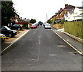
Quarry Road south of Longmead Road, Ryde
The houses here are all on the west side of the road, opposite allotments.
Image: © Jaggery
Taken: 10 Oct 2015
0.00 miles
2
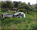
Southern edge of Quarry Road Allotments, Ryde
Extending for 300 metres, the allotments occupy an area of land of variable width between Quarry Road and the Island Line railway. Viewed from the Quarry Road perimeter fence.
Image: © Jaggery
Taken: 10 Oct 2015
0.03 miles
3
Quarry Road gas valve location markers, Ryde
The markers are near a gas installation http://www.geograph.org.uk/photo/4696416 on the left.
Image: © Jaggery
Taken: 10 Oct 2015
0.04 miles
4
West up Alfred Street, Ryde
Alfred Street ascends from Quarry Road.
Image: © Jaggery
Taken: 10 Oct 2015
0.04 miles
5
Quarry Road gas installation, Ryde
Inside a wooden enclosure opposite the Longmead Road junction. http://www.geograph.org.uk/photo/4696117
Image: © Jaggery
Taken: 10 Oct 2015
0.04 miles
6
Quarry Road houses, Ryde
On the west side of Quarry Road, south of the Sandcroft Avenue junction. http://www.geograph.org.uk/photo/4696042
Quarry Road Allotments perimeter fence is on the east side of the road.
Image: © Jaggery
Taken: 10 Oct 2015
0.05 miles
7
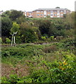
Island Line semaphore signal, Ryde
The signal is on the Island Line railway between Ryde St John's Road station
and Smallbrook Junction station. Viewed from the southern end of Quarry Road.
Image: © Jaggery
Taken: 10 Oct 2015
0.05 miles
8
Towards the southern end of Quarry Road, Ryde
South of the Alfred Street junction, http://www.geograph.org.uk/photo/4696194 Quarry Road ends at the edge of a track behind the cars.
A nearby sign shows that the track is part of Public Footpath R103 to Smallbrook.
Image: © Jaggery
Taken: 10 Oct 2015
0.06 miles
9
West up Longmead Road, Ryde
Ascending from Quarry Road.
Image: © Jaggery
Taken: 10 Oct 2015
0.06 miles
10
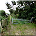
Track beyond the southern end of Quarry Road, Ryde
A sign behind the camera shows that this track is part of Public Footpath R103 to Smallbrook.
Image: © Jaggery
Taken: 10 Oct 2015
0.06 miles


