IMAGES TAKEN NEAR TO
Turnpike Close, CHICHESTER, PO19 8SU
Introduction
This page details the photographs taken nearby to Turnpike Close, PO19 8SU by members of the Geograph project.
The Geograph project started in 2005 with the aim of publishing, organising and preserving representative images for every square kilometre of Great Britain, Ireland and the Isle of Man.

There are currently over 7.5m images from over14,400 individuals and you can help contribute to the project by visiting https://www.geograph.org.uk
Image Map
Images are licensed for reuse under creativecommons.org/licenses/by-sa/2.0
Notes
- Clicking on the map will re-center to the selected point.
- The higher the marker number, the further away the image location is from the centre of the postcode.
Image Listing (25 Images Found)
Images are licensed for reuse under creativecommons.org/licenses/by-sa/2.0
Image
Details
Distance
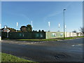
1
The corner of Turnpike Road and St Georges Road
Image: © David Howard
Taken: 22 Aug 2011
0.01 miles
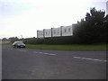
2
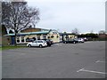
The Selsey Tram, Stockbridge
Public house of the junction of the A286 and the B2201. For a close-up of the sign see Image
Image: © Maigheach-gheal
Taken: 15 Feb 2010
0.08 miles
3
Stockbridge
The junction of the A286 and B2201 with the Selsey Tram restaurant on the right.
Image: © Brendan and Ruth McCartney
Taken: 22 Apr 2005
0.09 miles
4
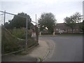
The junction of Selsey Road and Birdham Road
Image: © David Howard
Taken: 22 Aug 2011
0.10 miles
5
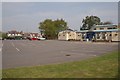
Site of the former public house, The Selsey Tram
Situated at the corner of the A286 and B2201, two and three bedroom houses are to fill the space.
Image: © Dave Spicer
Taken: 26 Jan 2013
0.11 miles
6
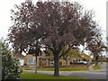
Copper beech
A young copper beech at the corner of Crosbie Close in Stockbridge, Chichester.
Image: © Kay Atherton
Taken: 26 Oct 2007
0.11 miles
7
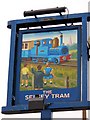
Sign for the Selsey Tram
The pub name recalls a horse-drawn tram that ran locally until 1932. The enterprise rejoiced in the title of the Hundred of Manhood and Selsey Light Railway. 'Manhood', the name of the ancient 'hundred' (a sub-division of a county) is a corruption of the Old English words meaning 'common wood'. But, the image looks more like Thomas the Tank Engine to me.
Image: © Maigheach-gheal
Taken: 15 Feb 2010
0.11 miles
9
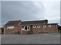
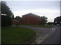
AKA St George, Donnington
The village hall, right in the centre of the modern village, doubles up as a church as the medieval building is slap bang in the middle of a very muddy field!
Image: © Basher Eyre
Taken: 23 Oct 2015
0.13 miles
10
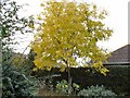
Robinia in autumn
Some late yellow roses under a Robinia pseudoacacia.
Image: © Kay Atherton
Taken: 26 Oct 2007
0.14 miles