IMAGES TAKEN NEAR TO
Oliver Whitby Road, CHICHESTER, PO19 3LL
Introduction
This page details the photographs taken nearby to Oliver Whitby Road, PO19 3LL by members of the Geograph project.
The Geograph project started in 2005 with the aim of publishing, organising and preserving representative images for every square kilometre of Great Britain, Ireland and the Isle of Man.

There are currently over 7.5m images from over14,400 individuals and you can help contribute to the project by visiting https://www.geograph.org.uk
Image Map
Images are licensed for reuse under creativecommons.org/licenses/by-sa/2.0
Notes
- Clicking on the map will re-center to the selected point.
- The higher the marker number, the further away the image location is from the centre of the postcode.
Image Listing (3 Images Found)
Images are licensed for reuse under creativecommons.org/licenses/by-sa/2.0
Image
Details
Distance
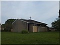
2
Sherborne Road and recreation area
An open space in the estate with sports facilities
Image: © David Smith
Taken: 30 Apr 2014
0.22 miles
3
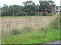
New Cottages seen from the New Lipchis Way
Between Chichester and Binderton the New Lipchis Way uses a stretch of the Centurion Way which is a route for walkers and pedal cyclists partly based on the defunct rail line north from Chichester.
Image: © Shazz
Taken: 16 Sep 2008
0.22 miles