IMAGES TAKEN NEAR TO
Halnaker, CHICHESTER, PO18 0NQ
Introduction
This page details the photographs taken nearby to PO18 0NQ by members of the Geograph project.
The Geograph project started in 2005 with the aim of publishing, organising and preserving representative images for every square kilometre of Great Britain, Ireland and the Isle of Man.

There are currently over 7.5m images from over14,400 individuals and you can help contribute to the project by visiting https://www.geograph.org.uk
Image Map
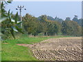
Images are licensed for reuse under creativecommons.org/licenses/by-sa/2.0
Notes
- Clicking on the map will re-center to the selected point.
- The higher the marker number, the further away the image location is from the centre of the postcode.
Image Listing (26 Images Found)
Images are licensed for reuse under creativecommons.org/licenses/by-sa/2.0
Image
Details
Distance
1
New vineyard by footpath 369 at Halnaker
Image: © Dave Spicer
Taken: 27 May 2012
0.03 miles
3
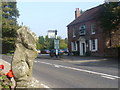
Halnaker, West Sussex
Hamlet east of Chichester, on the main A285 which here follows the alignment of Stane Street. This was the Roman road between Chichester and London. The Anglesey Arms is the building across the road.
http://www.british-history.ac.uk/report.aspx?compid=41725
Image: © Colin Smith
Taken: 9 Oct 2010
0.04 miles
4
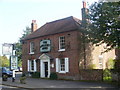
The Anglesey Arms, Halnaker
Country pub serving good food & drink, with a large beer garden, in the hamlet of Halnaker east of Chichester.
Image: © Colin Smith
Taken: 9 Oct 2010
0.05 miles
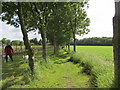
5
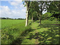
Footpath at Halnaker
Following a field edge. The field has been recently harrowed and the trees are showing the first tinges of autumn.
Image: © Colin Smith
Taken: 9 Oct 2010
0.06 miles
6
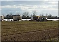
Planting Lettuces
Looking SW towards Boxgrove Church.
Image: © Janine Forbes
Taken: 5 Mar 2006
0.07 miles
7
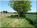
Path adjacent to vineyard
Public footpath 369 to Tinwood Lane.
Image: © Peter Holmes
Taken: 15 Jun 2013
0.07 miles
8
Power lines above path
Public footpath 284 to Halnaker.
Image: © Peter Holmes
Taken: 15 Jun 2013
0.08 miles
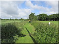
9
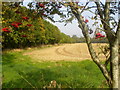
Farmland by Halnaker
Autumn and there are red berries and a recently harrowed field. A grassy footpath follows the field edge.
Image: © Colin Smith
Taken: 9 Oct 2010
0.09 miles
10
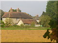
Flint Cottage at Halnaker
Large cottage of local stone, on Stane Street's alignment near Boxgrove.
http://www.british-history.ac.uk/report.aspx?compid=41725
Image: © Colin Smith
Taken: 9 Oct 2010
0.10 miles