IMAGES TAKEN NEAR TO
Robinson Road, FAREHAM, PO14 2DG
Introduction
This page details the photographs taken nearby to Robinson Road, PO14 2DG by members of the Geograph project.
The Geograph project started in 2005 with the aim of publishing, organising and preserving representative images for every square kilometre of Great Britain, Ireland and the Isle of Man.

There are currently over 7.5m images from over14,400 individuals and you can help contribute to the project by visiting https://www.geograph.org.uk
Image Map
Images are licensed for reuse under creativecommons.org/licenses/by-sa/2.0
Notes
- Clicking on the map will re-center to the selected point.
- The higher the marker number, the further away the image location is from the centre of the postcode.
Image Listing (5 Images Found)
Images are licensed for reuse under creativecommons.org/licenses/by-sa/2.0
Image
Details
Distance
3
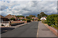
Pilgrims Way, Stubbington
A residential cul de sac, seen looking towards the hammer head at its northern end.
Image: © Peter Facey
Taken: 18 Aug 2014
0.11 miles
5
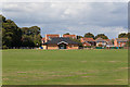
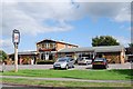
Football Pavilion at Seafield Park
A car park is to its left, and a children's play ground to the right. Vehicular access is from the north, via Bell Davies Road. For a wider view see Image
Image: © Peter Facey
Taken: 18 Aug 2014
0.20 miles