IMAGES TAKEN NEAR TO
Fareham Road, GOSPORT, PO13 0AQ
Introduction
This page details the photographs taken nearby to Fareham Road, PO13 0AQ by members of the Geograph project.
The Geograph project started in 2005 with the aim of publishing, organising and preserving representative images for every square kilometre of Great Britain, Ireland and the Isle of Man.

There are currently over 7.5m images from over14,400 individuals and you can help contribute to the project by visiting https://www.geograph.org.uk
Image Map
Images are licensed for reuse under creativecommons.org/licenses/by-sa/2.0
Notes
- Clicking on the map will re-center to the selected point.
- The higher the marker number, the further away the image location is from the centre of the postcode.
Image Listing (90 Images Found)
Images are licensed for reuse under creativecommons.org/licenses/by-sa/2.0
Image
Details
Distance
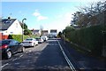
3
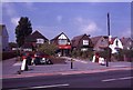
Cash Stores
This Post Office and grocery store was called Cash Stores I believe for a period in the 1950's and/or 1960's. This picture was taken shortly before it closed down and is now a private residence.
Image: © Barry Shimmon
Taken: Unknown
0.05 miles
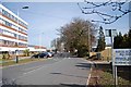
4
Bridgemary Way
This cul-de-sac (formerly a road) was closed off from the A32 around about 1992.
Image: © Barry Shimmon
Taken: 1 Apr 2010
0.07 miles


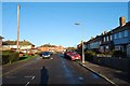
7
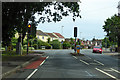
Traffic lights on A32 Fareham Road
At the junction with Lederle Lane.
Image: © Robin Webster
Taken: 5 Jun 2019
0.08 miles
9
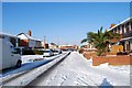
Bridgemary under snow - Prideaux-Brune Avenue (2)
Image: © Barry Shimmon
Taken: 9 Jan 2010
0.09 miles